Typhoon “Hinnamnor” reaches super typhoon strength, becomes the strongest tropical cyclone of the year
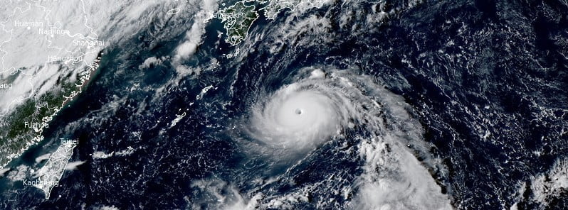
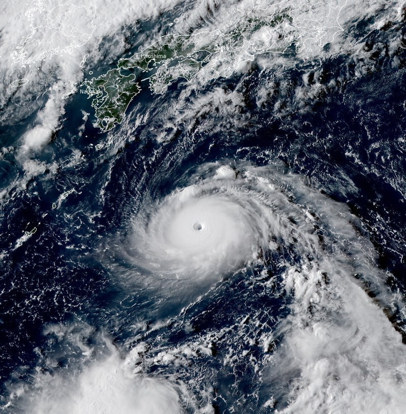
Typhoon “Hinnamnor” formed on August 28, 2022, and reached super typhoon strength by 12:00 UTC on August 30, making it the strongest tropical cyclone of the year. The system is currently located well east of Okinawa, Japan, and is heading west at 28 km/h (17 mph).
At 12:00 UTC on August 30, the center of Super Typhoon “Hinnamnor” was located about 575 km (360 miles) east of Kadena Air Base, Okinawa, Japan.
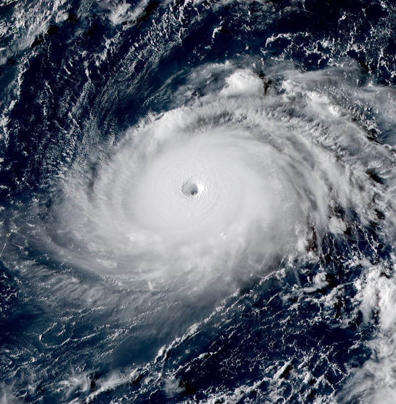
It had maximum 10-minute sustained winds of 195 km/h (120 mph), with gusts up to 280 km/h (175 mph).
According to the JTWC, Hinnamnor’s maximum 1-minute sustained winds were at 240 km/h (150 mph) – making it a Super Typhoon.
The minimum central barometric pressure was 920 hPa, and the system was moving west at 28 km/h (17 mph).
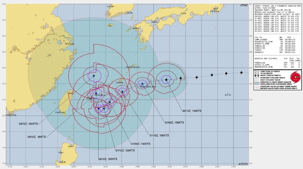
Hinnamnor is forecast to continue tracking generally westward over the next 12 hours under the steering influence of the subtropical ridge to the northeast, JTWC said.1
Still in a favorable environment characterized by warm sea surface temperatures, low vertical wind shear and moderate outflow aloft, the typhoon is forecast to reach a potential peak intensity of 250 km/h (155 mph) or higher by 15:00 UTC on August 31.
References:
1 Supertyphoon “Hinnamnor” – Prognostic reasoning – JTWC 15:00 UTC on August 30, 2022
Featured image: Tropical Cyclone “Hinnamnor” at 07:10 UTC on August 30, 2022. Credit: JMA/Himawari-8, RAMMB/CIRA, The Watchers
Commenting rules and guidelines
We value the thoughts and opinions of our readers and welcome healthy discussions on our website. In order to maintain a respectful and positive community, we ask that all commenters follow these rules.