- News
- City News
- chennai News
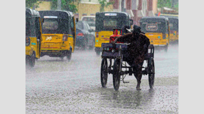
- Monsoon to gain pace from tomorrow, Chennai set for soaking
Trending
This story is from November 3, 2020
Monsoon to gain pace from tomorrow, Chennai set for soaking
The brief lull in the northeast monsoon may be over in a day.

While the city skies are likely to be partly cloudy on Tuesday, monsoon could pick up pace on Wednesday
CHENNAI: The brief lull in the northeast monsoon may be over in a day.
The season would pick up pace over the state by incoming strong easterlies as weathermen have forecast thunderstorms and moderate spells over the city during late nights or early mornings followed by day spells in interior districts starting from November 4. Weather enthusiasts said the intermittent and widespread rainfall, which would continue over many parts of the state including Chennai till November 8 will be followed by remnants of cyclone Goni and the global climate phenomenon called Madden Julian Oscillation (MJO) are likely to keep monsoon season active through the month.
While the city skies are likely to be partly cloudy on Tuesday, monsoon could pick up pace on Wednesday as IMD has forecast, “The sky condition is likely to be partly cloudy. Thunderstorms with light rain are likely in some areas. Maximum and minimum temperatures are likely to be around 34°C and 25°C for the next 48 hours.”
“This is likely due to a cyclonic circulation which is closer to Tamil Nadu coast and southwest Bay of Bengal,” an IMD official said.
5.
Weather enthusiasts said an easterly wave or an elongated area of low air pressure moving from east to west could bring regular early morning spells to the city when low level winds enter the trough this wave and converge resulting in rainfall. As the easterly wave penetrates interior areas during the day, winds will converge bringing rainfall to interior districts. This may last between November 4 and 8.
Blogger Pradeep John said the next round of spells will be likely around November 10 when remnants of Cyclone Goni, dubbed as the world’s strongest cyclone in 2020, which slammed the Philippines, would enter Indian region bringing rainfall. By that time, MJO- the eastward moving disturbance of clouds, rainfall, winds and pressure that travels across the tropics and returns to its starting point in 30 to 60 days- will enter phase-2 and 3. In this phase, enhanced convective rainfall moves slowly eastwards over Africa, Indian Ocean and parts of the Indian subcontinent. “It will enter this region in the second week of November. Monsoon will stay active through this month and most of December,” he said.
The season would pick up pace over the state by incoming strong easterlies as weathermen have forecast thunderstorms and moderate spells over the city during late nights or early mornings followed by day spells in interior districts starting from November 4. Weather enthusiasts said the intermittent and widespread rainfall, which would continue over many parts of the state including Chennai till November 8 will be followed by remnants of cyclone Goni and the global climate phenomenon called Madden Julian Oscillation (MJO) are likely to keep monsoon season active through the month.
While the city skies are likely to be partly cloudy on Tuesday, monsoon could pick up pace on Wednesday as IMD has forecast, “The sky condition is likely to be partly cloudy. Thunderstorms with light rain are likely in some areas. Maximum and minimum temperatures are likely to be around 34°C and 25°C for the next 48 hours.”
“This is likely due to a cyclonic circulation which is closer to Tamil Nadu coast and southwest Bay of Bengal,” an IMD official said.
While interior and western districts like Madurai, Dindigul, Coimbatore and Theni are likely to get thunderstorm with light to moderate rain on Tuesday, IMD has forecast similar rainfall pattern to occur at many places over south Tamil Nadu, interior Tamil Nadu, Chennai, Puducherry and Karaikal area on November 4 and
5.
Weather enthusiasts said an easterly wave or an elongated area of low air pressure moving from east to west could bring regular early morning spells to the city when low level winds enter the trough this wave and converge resulting in rainfall. As the easterly wave penetrates interior areas during the day, winds will converge bringing rainfall to interior districts. This may last between November 4 and 8.
Blogger Pradeep John said the next round of spells will be likely around November 10 when remnants of Cyclone Goni, dubbed as the world’s strongest cyclone in 2020, which slammed the Philippines, would enter Indian region bringing rainfall. By that time, MJO- the eastward moving disturbance of clouds, rainfall, winds and pressure that travels across the tropics and returns to its starting point in 30 to 60 days- will enter phase-2 and 3. In this phase, enhanced convective rainfall moves slowly eastwards over Africa, Indian Ocean and parts of the Indian subcontinent. “It will enter this region in the second week of November. Monsoon will stay active through this month and most of December,” he said.
End of Article
FOLLOW US ON SOCIAL MEDIA


