Tropical Storm “Chaba” heading toward China, landfall forecast on July 2
Tropical Storm “Chaba” formed on June 29, 2022, over the South China Sea as the 3rd named storm of the 2022 Pacific typhoon season.
- The storm is forecast to continue strengthening as it moves NW toward Hainan and make landfall in an area NE of the island on July 2, with maximum sustained winds up to ~110 km/h (68 mph), possibly stronger.
- Heavy rainfall is forecast over Guangdong Province and Hainan ahead of the landfall.
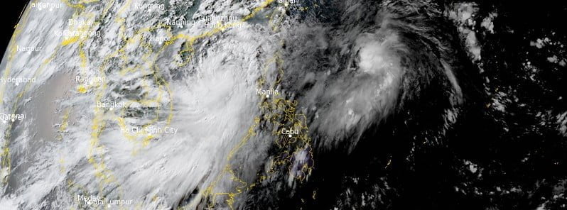
At 12:00 UTC on June 30, the center of Tropical Storm “Chaba” was located about 665 km (415 miles) WNW of Manila, Philippines.
Maximum 10-minute sustained winds were 85 km/h (50 mph), with gusts up to 120 km/h (75 mph), while maximum 1-minute sustained winds were at 75 km/h (45 mph).
The minimum central barometric pressure was 990 hPa, and the system was moving NNE at 11 km/h (6.9 mph).
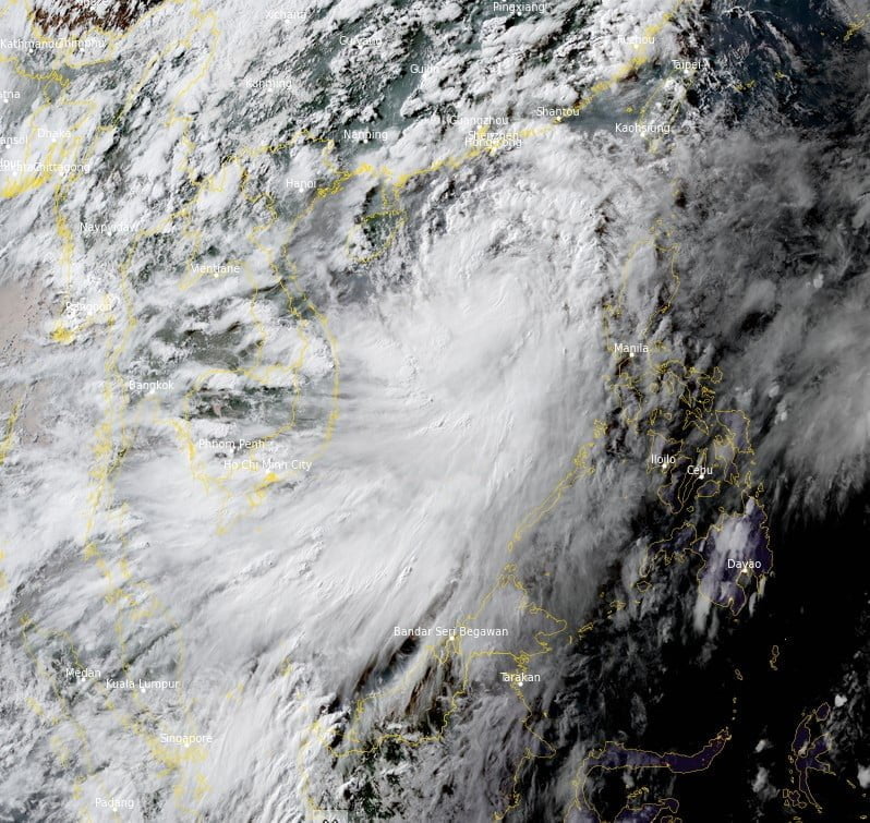
Chaba is forecast to track NW in a favorable environment before making landfall east of Luichow Peninsula, China on July 2, JTWC forecasters noted.1
Environmental conditions are forecast to remain favorable, characterized by warm sea surface temperatures (30 °C / 86 °F), moderate divergence aloft, and low-moderate vertical wind shear (9-16 knots) which will allow Chaba to reach a potential maximum intensity of 130 km/h (80 mph) by 03:00 UTC on July 2.
Between 03:00 and 15:00 UTC on July 2, Chaba will begin to interact with both the island of Hainan and eventually mainland China, significantly impacting intensity as the system continues to track northwestward.
Between 15:00 UTC on July 2 and 15:00 UTC on July 3, the system will steady up on an approximate NNE track as it continues to succumb to the orographic impacts of southern China before finally dissipating on July 5.
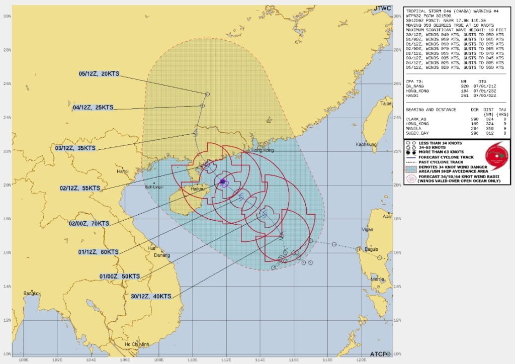
There is a possibility for a more dramatic intensification trend through over the next 36 hours with a bulk of the models disagreeing on the extent of peak intensity, thus JTWC intensity forecast is placed with medium confidence.
References:
1 Tropical Storm 04W (Chaba) Warning #04 Issued at 30/1500Z – Prognostic Reasoning – JTWC
Featured image: Tropical Storm “Chabu” at 09:30 UTC on June 30, 2022. Credit: JMA/Himawari-8, RAMMB/CIRA, The Watchers
Commenting rules and guidelines
We value the thoughts and opinions of our readers and welcome healthy discussions on our website. In order to maintain a respectful and positive community, we ask that all commenters follow these rules:
We reserve the right to remove any comments that violate these rules. By commenting on our website, you agree to abide by these guidelines. Thank you for helping to create a positive and welcoming environment for all.