Very strong and shallow M7.0 earthquake hits Luzon, Philippines
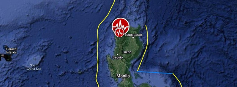
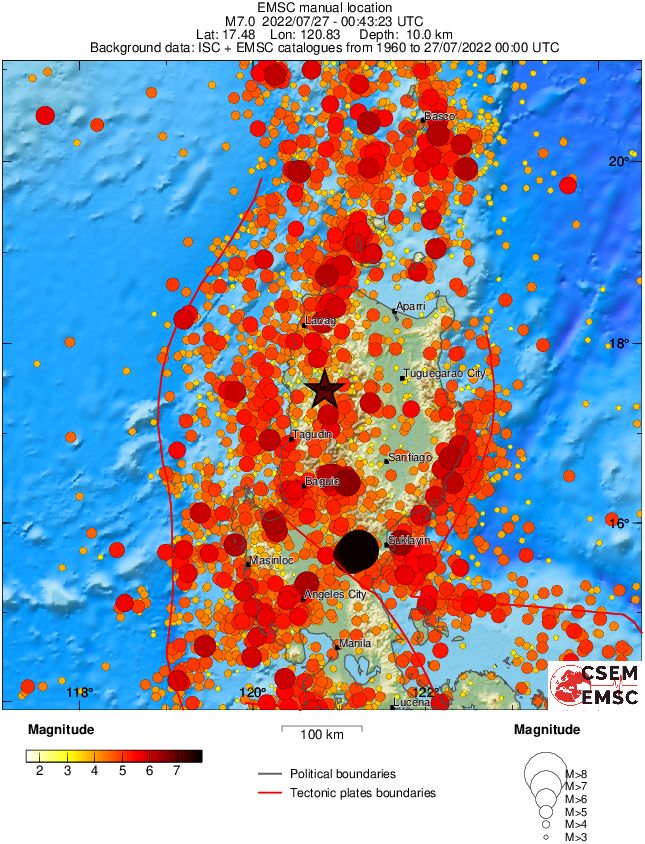
A very strong and shallow earthquake registered by PHIVOLCS as M7.0 hit Luzon, Philippines at 00:43 UTC (08:43 LT) on July 27, 2022. The agency is reporting a depth of 17 km (10.5 miles). USGS is reporting M7.0 at a depth of 10 km (6.2 miles), EMSC M7.1 at a depth of 10 km (6.2 miles).
- The quake damaged numerous homes and buildings, leaving at least 5 people dead and 130 injured.
- Landslides were reported across the region.
- Telecommunication and electric power distribution infrastructure were damaged, leading to loss of signal and power interruptions.
- The Armed Forces of the Philippines has been instructed to mobilize all of its assets to assist affected communities.
- More than 220 aftershocks were registered over the next 4 hours.
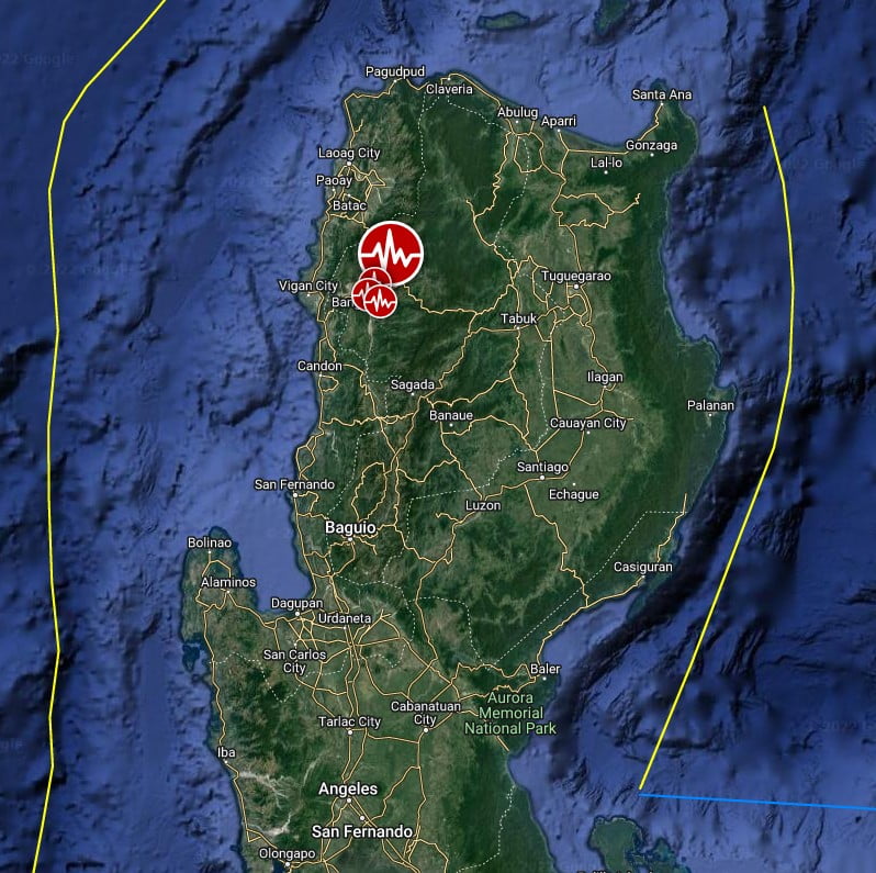
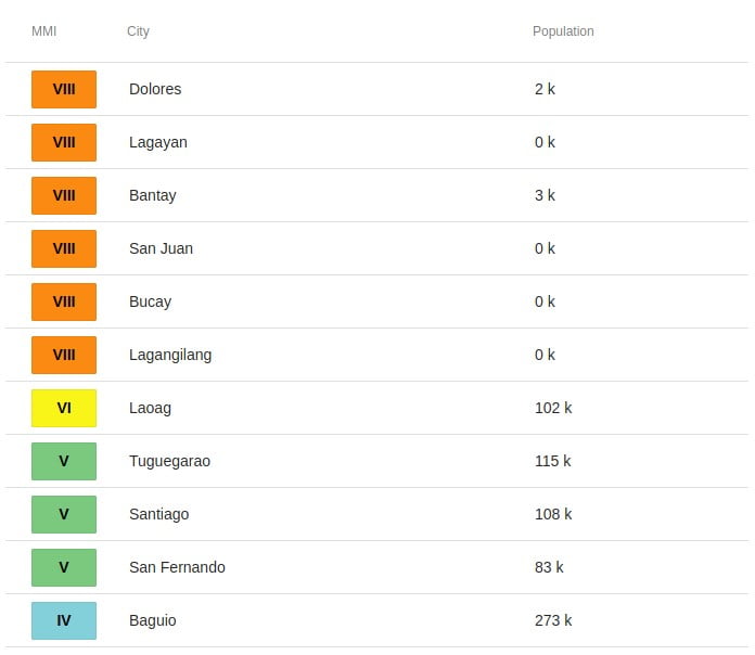
The epicenter was located in the province of Abra, 13.8 km (8.6 miles) SE of Dolores (population 2 378), 40.4 km (25.1 miles) WNW of Pasil (population 10 109), and 98 km (60.9 miles) W of Tuguegarao (population 115 105), Philippines.
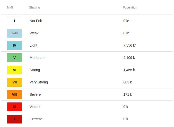
171 000 people are estimated to have felt severe shaking, 663 000 very strong, 1 565 000 strong and 4 109 000 moderate.
The USGS issued a Yellow alert for shaking-related fatalities and economic losses. Some casualties and damage are possible and the impact should be relatively localized. Past yellow alerts have required a local or regional level response.
Estimated economic losses are less than 1% of GDP of Philippines.
Overall, the population in this region resides in structures that are a mix of vulnerable and earthquake-resistant construction. The predominant vulnerable building types are unknown/miscellaneous types and heavy wood frame construction.
Recent earthquakes in this area have caused secondary hazards such as tsunamis, landslides and liquefaction that might have contributed to losses.
Walls cracked on many houses and buildings, while some of them collapsed.
A villager died when he was hit by falling cement slabs in his house in Abra, where at least 25 others were injured and were mostly confined in hospitals, AP reported.
The second fatality is a construction worker hit by debris in the town of La Trinidad in Benguet province, where some roads were shut by landslides and boulders.
Five people were injured when rocks and debris pummeled their SUV and a truck on a hillside road in Mountain Province near Benguet, officials said.
Rescuers found two more bodies during the day, one in Benguet and one in another province.
Update, July 28
The number of fatalities rose to 5 and the number of injured to 130, on July 28.
The quake caused about $687 million of infrastructure damage, according to the Philippine National Disaster Risk Reduction and Management Center.
Infrastructure was damaged across northern Luzon, including more than 400 homes, dozens of schools, several hospitals and bridges, and the centuries-old Vigan Cathedral and Banta Bell Tower, the Office of Civil Defense said.
Power has been restored in the majority of areas, he said, but access to water remains a problem, President Ferdinand Marcos Jr. said.
Interior Secretary Benjamin Abalos Jr. said in a news conference that 58 landslides had been reported, and more than 200 towns in 15 provinces were affected by the quake. (CNN)

Estimated population exposure to earthquake shaking
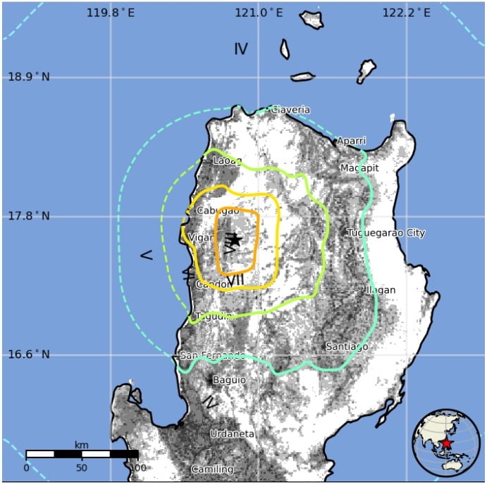
Selected cities exposed
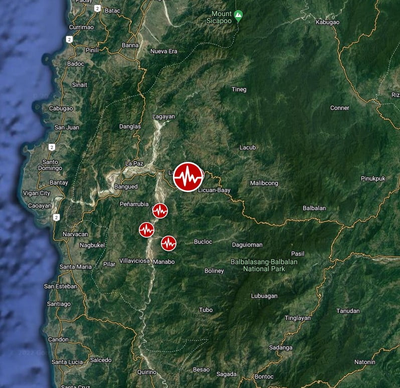
Regional seismicity
Multimedia
Featured image credit: TW/SAM, Google
Likely a lot bigger than a 7.0. USGS has been lying about the size of quakes the last few years. Want to keep people from getting alarmed and then they start asking questions. Guess they lean on the other reporting agencies to comply. Big things are unfolding.