Extensive and very dangerous ice storm hits U.S.

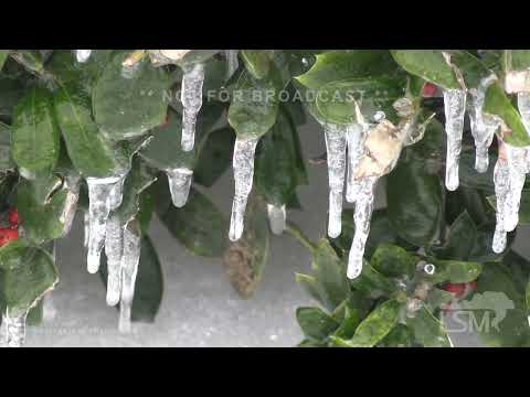
A glancing blow of Arctic air mixed with a surge in moisture set the stage for an extensive and very dangerous ice event in parts of the United States. The most likely corridor of icing with a mixture of sleet will occur from west-central Texas to the Tennessee and Lower Ohio Valleys, NWS warns. The ice accretion from Texas into Mid-South may approach 13 mm (0.5 inches) or more through Wednesday, February 1, 2023, and cause power outages and travel issues.
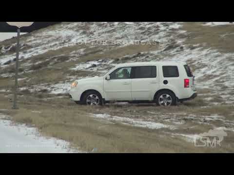
Abundant freezing rain and sleet across the southern Plains have already resulted in a travel nightmare for many on Monday, January 30, including a fatal wreck in Avoca, Arkansas when a flatbed truck lost control and flipped on a road, and chaos in the Dallas-Fort Worth metro region, resulting in over 100 crashes and 25 injured people.
Close to 13 mm (0.5 inches) of sleet was reported on roads south of Denton, Texas, on Monday afternoon and up to 25 mm (1 inch) in towns in Oklahoma and Arkansas, as well as 20 mm (0.8 inches) in Branson, Missouri.
Air travel was also heavily impacted, with both major Dallas-Fort Worth airports canceling or delaying more than 1 000 flights. Additional flight delays and cancellations are expected to continue at major hubs such as Austin, Dallas, and Memphis today.
AccuWeather forecasters warned that yesterday’s severe weather was just the first wave of ice with more expected from another storm that is forecast for Tuesday, January 31. Major hubs such as Dallas, Austin, Oklahoma City and Memphis are just some of the cities where a substantial amount of ice could be received.1


The headlining weather story in the United States over the next few days will be the ongoing ice storm affecting portions of the southern Plains and Mid-South that is forecast to continue into at least early Thursday, February 2.2
In the wake of an arctic cold frontal passage, warm and moist air overrunning cold air at the surface draped over the region will produce freezing rain and sleet that could lead to significant impacts.
Furthermore, multiple rounds of wintry precipitation are forecast, with brief lulls followed by bursts of sleet and freezing rain that could drastically deteriorate road conditions.
Widespread total ice accretion of greater than 6 mm (0.25 inches) is likely from West Texas to western Tennessee, with localized areas receiving as much as 19 mm (0.75 inches).
In addition to potentially hazardous travel conditions, this amount of ice will likely lead to tree damage and scattered power outages across the hardest-hit regions.
Sleet accumulations around 13 mm (0.5 inches) or locally higher are also possible from West Texas to Arkansas, which can also lead to treacherous travel or add to the already slippery conditions.
As a result, Ice Storm Warnings, Winter Storm Warnings, and Winter Weather Advisories have been issued. Travelers are advised to check road conditions before venturing out and drive with extreme caution.
The cold airmass responsible for the icy forecast in the Mid-South will also lead to one more morning of well-below-average temperatures and frigid wind chills throughout the central and western United States. Widespread temperature departures of 5 – 15 °C (10 – 30 °F) below average are forecast throughout much of the Plains and Intermountain West this morning, January 31, with temperatures below zero in many spots.
Bitterly cold air, coupled with gusty winds, has led to the issuance of Wind Chill Warnings and Advisories across the central and northern Plains, as well as parts of the Intermountain West.
Wind chill values are forecast to drop as low as -40 °C/F to start the day before temperatures begin to rebound for the next few days.
The next shot of arctic air is anticipated to enter North Dakota and the Upper Midwest by Thursday.
Elsewhere, numerous showers and thunderstorms are forecast to develop and push eastward from eastern Texas beginning on Wednesday while lake effect snow continues deep into this winter with several additional inches of fresh snow likely along the western-facing lakefronts. The highest accumulations are forecast downwind of Lake Ontario, where 30 cm (1 foot) of snow is possible.
References:
1 Icy conditions attributed to fatal crash, travel nightmare for southern Plains – AccuWeather – January 30/31, 2023
2 Short Range Forecast Discussion – NWS Weather Prediction Center College Park MD – 232 AM EST Tue Jan 31 2023
Featured image credit: Live Storms Media (stillshot from the video)
Commenting rules and guidelines
We value the thoughts and opinions of our readers and welcome healthy discussions on our website. In order to maintain a respectful and positive community, we ask that all commenters follow these rules:
We reserve the right to remove any comments that violate these rules. By commenting on our website, you agree to abide by these guidelines. Thank you for helping to create a positive and welcoming environment for all.