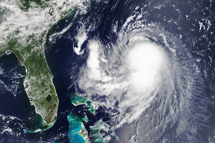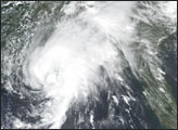
Nicholas only reached hurricane strength for a few hours, but like two other storms in the North Atlantic basin this season, it showed that a tropical cyclone need not have fierce winds to wreck havoc. Like Elsa and Henri earlier this summer, slow-moving Tropical Storm Nicholas has dropped flooding rainfall that has not yet subsided along the Gulf Coast of the United States.
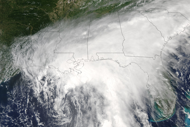
Since landfall early on September 14, 2021, Nicholas has brought torrential rainfall to Galveston, Houston, and other parts of southeastern Texas and southwestern Louisiana. As of the afternoon of September 15, the remnant tropical depression was lingering over Louisiana, Mississippi, Alabama, and the Florida Panhandle, dropping heavy rain on soils still saturated and waterways still full to the brim after Hurricane Ida. More than half of Louisiana has been under a flood watch, and some isolated areas were expected to see rainfall totals measuring as much as 10 to 20 inches (25 to 50 centimeters).
As has long been predicted by climate scientists, the atmosphere now generally holds more moisture due to global warming. This has led to stronger and more frequent downpours—even within everyday rainstorms—and more stalling storms that drop excessive amounts of rain in focused areas. So far, Nicholas seems to be following this sort of pattern. Hurricane Harvey performed a devastating, long-lasting dance along the Gulf Coast in 2017.
As pointed out by scientists at the Cooperative Institute for Meteorological Satellite Studies, Nicholas also had an extra fuel source: an atmospheric flow of moisture from the tropics. Earth has a persistent band of rain-producing clouds that hover around the tropics due to the way trade winds meet near the equator and push moisture up in the atmosphere. Scientists refer to this area as the intertropical convergence zone. Data and models suggest that Nicholas may be pulling in moisture from this region.
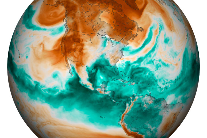
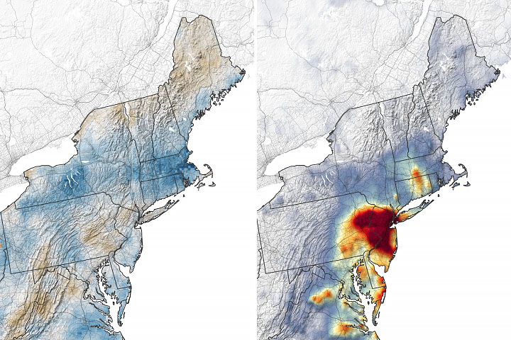
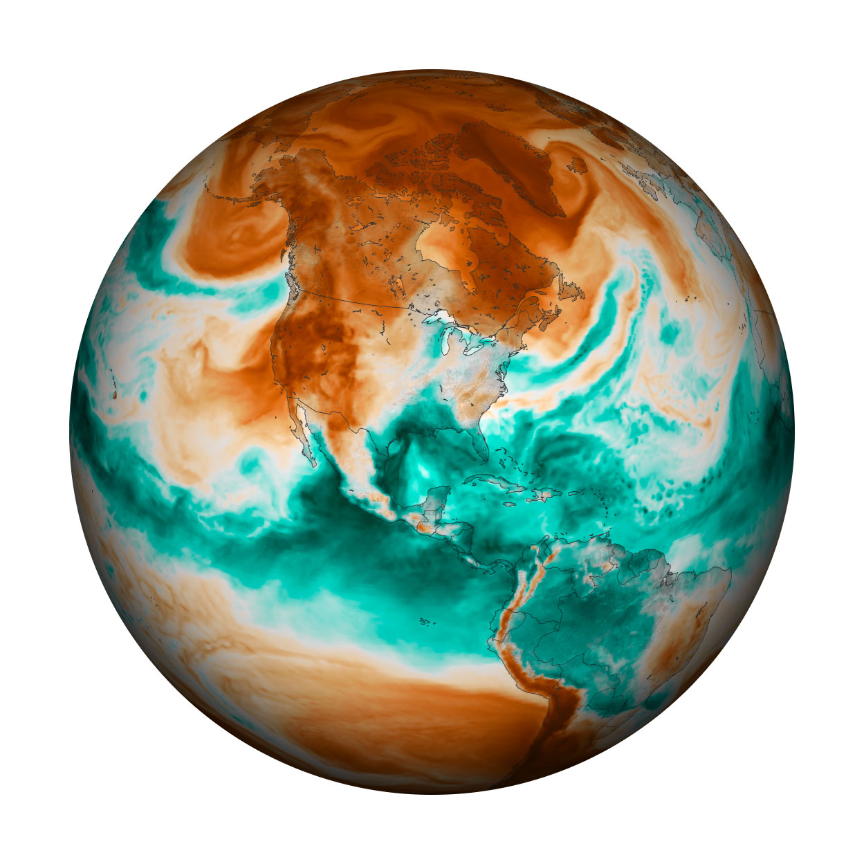
The map above is a snapshot of the total precipitable water vapor in the atmosphere over North and Central America in the early morning on September 14, 2021. Total precipitable water is a way of representing the amount of water vapor in a column from the ground surface to the top of the atmosphere as if it all condensed to liquid and fell from the sky. The map is based on a version of a NASA model known as the Earth Observing System Data Assimilation System (GEOS DAS), which uses satellite data and mathematical representations of physical processes to calculate what was happening in the atmosphere.
In a recent report from the Intergovernmental Panel on Climate Change, scientists drew an unequivocal link between human activity and global warming. They also pointed to an observed increase in the intensity and frequency of heavy precipitation events in North America as a consequence of warming. Scientists project that an increase in both mean and extreme precipitation is very likely in the future.
NASA Earth Observatory image by Joshua Stevens, using GEOS-5 data from the Global Modeling and Assimilation Office at NASA GSFC. Story by Michael Carlowicz.