Super Typhoon “Nanmadol” strengthening, forecast to slam into Kyushu, Japan
Nanmadol formed on September 13, 2022, as the 14th named storm of the 2022 Pacific typhoon season, strengthened to a typhoon on September 15, and reached super typhoon status on September 16. The system is still strengthening and is expected to reach Kyushu, Japan by September 18.
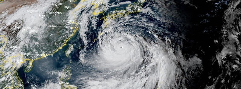
At 12:00 UTC on September 16, the center of Super Typhoon “Nanmadol” was located about 795 km (495 miles) east-southeast of Kadena Air Base, Okinawa, Japan.
Its maximum 10-minute sustained winds were at 175 km/h (110 mph), with gusts up to 250 km/h (155 mph), while maximum 1-minute sustained winds were at 240 km/h (150 mph), with gusts to 295 km/h (185 mph).
The minimum central barometric pressure was 925 hPa and the system was moving NW at 15 km/h (9.2 mph).
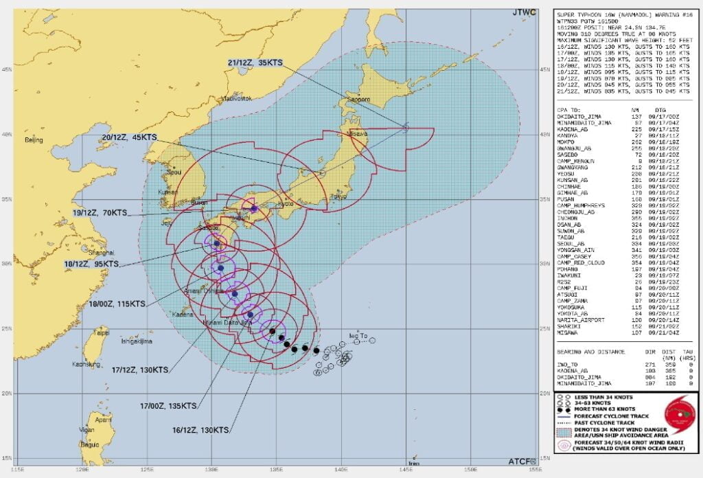
Super Typhoon “Nanmadol” will continue on its current track under the steering influence of the subtropical ridge to the northeast.1
After midnight UTC on September 18, it will crest the subtropical ridge axis and recurve northeastward, making landfall over Kyushu, Japan, near Sasebo just after 15:00 UTC.
Afterward, it will accelerate northeastward across Honshu and by 15:00 UTC on September 21 exit back into the Pacific Ocean east of Misawa.
The favorable conditions will fuel further intensification to a peak of 250 km/h (155 mph) by 00:00 UTC on September 17, afterward, cooling sea surface temperatures, increasing vertical wind shear, and land interaction will gradually erode the system.
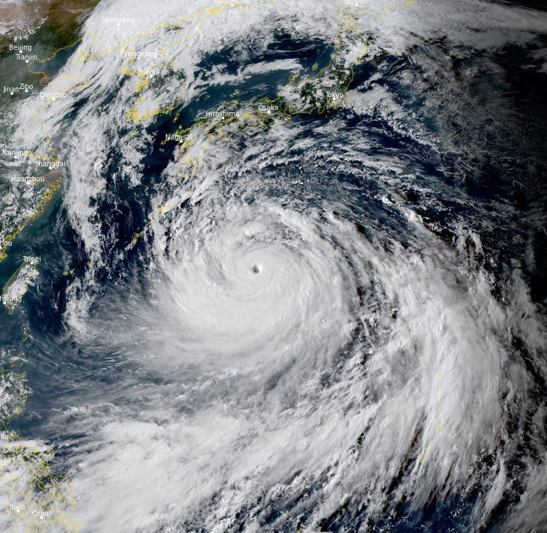
The typhoon threatens wide areas of Japan from the west to the north.2
Strong winds are feared in the Okinawa area on September 16, causing rough seas and large swells, while in the Amami region, extremely violent winds powerful enough to overturn running trucks and injure people are expected the following day.
Tide levels around the northern Kyushu and west Japan’s Chugoku and Shikoku regions will start rising around September 18, and dangerously high tides are feared in some parts of these regions.
The Japan Meteorological Agency (JMA) is warning people in low-lying areas such as near coastlines and river mouths about potential flooding caused by high waves.
The JMA is also calling on people in south Kyushu to be on their guard against landslides and swollen rivers on September 16, as some areas there recently received heavy rainfall before Nanmadol developed.
References:
1 Typhoon 16W (Nanmadol) JTWC Warning #15 – Issued at 15:00 UTC on September 16, 2022
2 Strong typhoon Nanmadol threatens to pound southwest Japan on Sept. 17 – The Mainichi – September 16, 2022
Featured image: Typhoon “Nanmadol” at 07:10 UTC on September 16, 2022. Credit: JMA/Himawari-8, RAMMB/CIRA, The Watchers
Commenting rules and guidelines
We value the thoughts and opinions of our readers and welcome healthy discussions on our website. In order to maintain a respectful and positive community, we ask that all commenters follow these rules:
We reserve the right to remove any comments that violate these rules. By commenting on our website, you agree to abide by these guidelines. Thank you for helping to create a positive and welcoming environment for all.