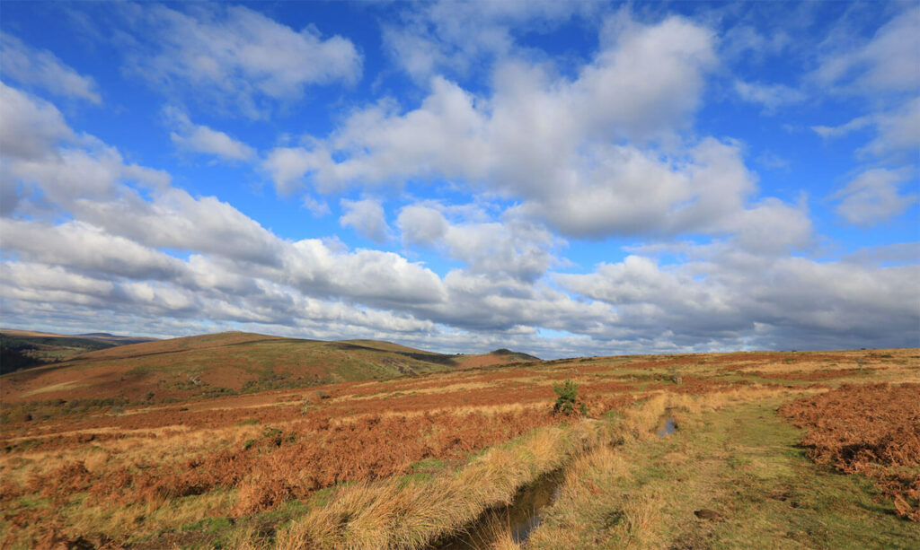
Dartmoor & North Devon
2019-2022
Project Code: 023
SWEEP has co-created novel remote sensing tools to map, monitor and enhance the South West’s natural landscapes. These are already supporting quicker, less costly and more effective decision making by those tasked with managing the south west’s vitally important natural resources.
Project team


Sara Zonneveld
Impact Fellow


Why it matters
We are working in an age of open access geospatial data that is free to use and available at fine spatial resolutions. This has the potential to revolutionise the way we understand and monitor patterns and dynamics across landscapes.
However, highly complex, technical remote sensing workflows are required to translate these data into user-friendly, up-to-date, fine spatial resolution maps that can inform more robust, evidence-based land management decision making. These require skills not often found in organisations.
Partners


This work has put us two or three years ahead of the game in terms of natural resource mapping data at landscape scale and therefore being able to deliver effectively on nature enhancement work. It simply wouldn’t have happened without SWEEP in this timeframe, and quite possibly would not have happened at all.
Richard Knott, DNPA
What we did
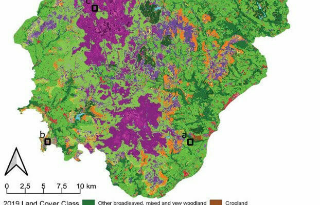
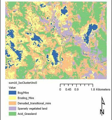
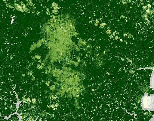
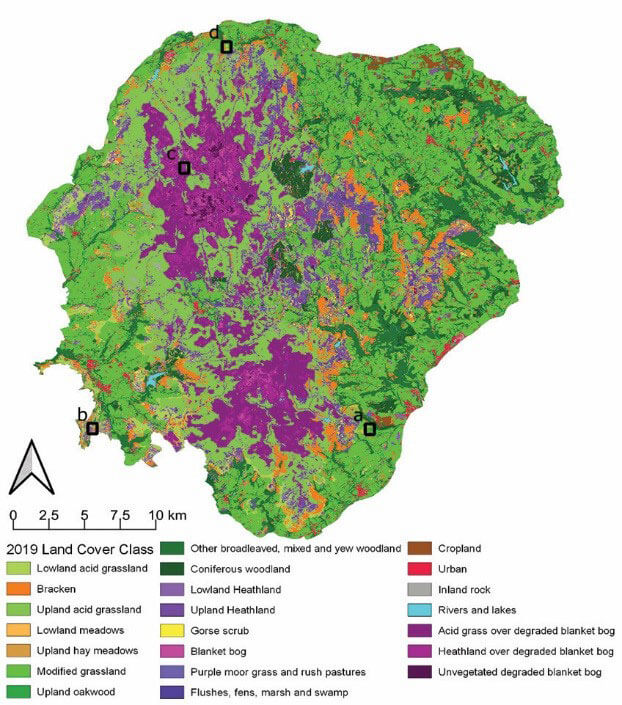
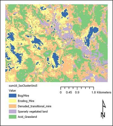
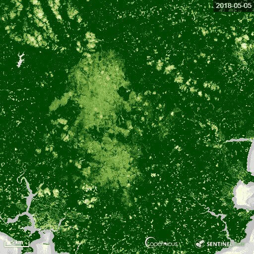
Using open source Earth Observation data they created a set of bespoke habitat mapping methods and tools. Responding to partner’s needs, the team created remote sensing workflows to develop the tools, and these produced fine resolution, robust and repeatable mapping of habitat classes within Dartmoor National Park, and wooded areas within the North Devon UNESCO Biosphere Reserve. This was achieved utilising spaceborne radar (Sentinel 1, SAR), multispectral imaging data (Sentinel 2) and Tellus LIDAR data, in combination with machine learning approaches.
Impacts & benefits
- Building capacity and culture shifts – our partner’s capacity to understand and use these kind of remote sensing tools and mapping outputs has been significantly boosted, enabling them, and the partners they support, do their jobs better and embed new ways of working. Having delivered SWEEP training to >50 others, and with the tools now open access, this capacity is extending rapidly throughout the sector.
- A step-change in habitat data for management purposes – the datasets, tools and mapping outputs have provided our partners with a unique, bespoke and repeatable evidence base, of the extent and change of habitat cover over time. This is enabling more effective natural capital decision making, policy and practice and significantly improves upon previously available data.
- Environmental enhancement, safeguarding and increased resilience – for the first time SWEEP’s tools are providing land managers with bespoke, accurate and repeatable landscape-scale habitat data enabling better decision making. This is already benefitting a wide range of work including nature recovery, Biodiversity New Gain, natural flood management, Defra’s Environmental Land Management Schemes, carbon storage interventions, woodland protection, restoration and creation – both for our partners, and wider stakeholders such as the Environment Agency, Natural England, RSPB, Devon Wildlife Trust and the MOD,
- Contributing to strategic direction shifts and policy development – SWEEP’s work has underpinned the development, and will be integral to the delivery and evaluation of, Dartmoor’s National Park Partnership Plan 2021-26, as well as the associated local DNPA plan and State of the Park report.
- Financial and economic benefits – SWEEP’s mapping is estimated to be saving our partners at least £750k/per 5 yrs in costs e.g. reducing the need for commercial mapping and ground surveys and enabling better allocation of resources to priority areas. The tools will play a key role in enabling North Devon realise c.£40m natural capital benefits and safeguarding or creating c.700 jobs by 2030, through better woodland creation and management. The work has already leveraged £6.7m of further funding, and a further £5.8m in expected.
SWEEP’s THaW tool has already proven key to helping us provide more responsive woodland management advice, for leveraging further investment to deliver impact on a larger, wider scale, and in helping to deliver North Devon’s considerable woodland targets towards 2030.
Andy Bell, North Devon UNESCO Biosphere Reserve
Looking to the future
Legacy and sustained impact has been built into this work from the robust science-based open source platforms on which the tools are constructed, the co-created process of development, the embedding of tools within partner organisations and their open access location. This is enabling the benefits to be extended more widely and for the tool to be further developed, and rolled out, both regionally and nationally, e.g. via programmes like NetZeroPlus.