
Image: Liverpool Town Hall, by Miguel Mendez, Wikimedia Commons (CC BY 2.0)
This post is by Guy Shrubsole.
Local authorities own some 1.3 million acres of land in England, making them collectively a very significant set of landowners.
But whilst this blog has previously looked at County Farms – council-owned agricultural tenancies – in some depth, I’ve never properly delved into the other sorts of land owned by local authorities. So that’s the subject of this post. Warning: it’s lengthy!
Whilst a lot of council land is the obvious sort – county halls, public parks, highways, and remaining council housing that hasn’t been sold off – my investigations have also thrown up some surprising findings. There are councils in England that own moorlands, saltmarshes, large areas of Green Belt and even vast expanses of foreshore – not to mention scores of golf courses. Collectively, English councils received almost £10m in farm subsidies in 2018, much of it Pillar II payments for looking after local nature reserves and country parks – money that could dry up post-Brexit.
I also take a look at the extent to which some metropolitan boroughs control landownership within their cities, and examine how council landholdings expanded historically with the rise of local government and declined after privatisation.
Overview of the data
English councils today own about 1.3m acres of land – around 4% of England’s 32m acres. That’s according to a 2015 Land Registry dataset, released under Freedom of Information laws to journalist Christian Eriksson, who passed it on to me. The dataset lists the area of land owned by each corporate landowner in England and Wales, including councils.
So I’ve extracted the land areas owned by English councils and put them in this Google Spreadsheet. From this, we can start to get an idea of the pattern and spread of local authority landholdings.
There are 353 councils in England. The top ten landowning councils own 225,514 acres, 17% of the total; the top thirty, 479,604 acres, 36% of the total; the top fifty, 659,601 acres, 50% of the total. Here are the top ten:
| Local authority | Area owned (acres) | CAP farm subsidies (2018) |
| Cambridgeshire County Council | 35,472 | £12,337 |
| Cornwall Council | 25,057 | £60,440 |
| Durham County Council | 25,051 | £239,611 |
| Norfolk County Council | 22,533 | £418,243 |
| Leeds City Council | 22,075 | £137,294 |
| Wirral Borough Council | 21,236 | £3,033 |
| Lincolnshire County Council | 21,124 | £390,888 |
| Sefton Borough Council | 18,475 | £10,265 |
| Staffordshire County Council | 18,132 | £293,710 |
| Sheffield City Council | 16,359 | £104,952 |
| Total for the top 10 councils | 225,514 acres | £1,670,776 |
The eagle-eyed will notice some of these councils getting large amounts in farm subsidies, but others hardly getting any. The reasons why will become clear later.
This being England, there isn’t just one type of council everywhere, but multiple varieties: 26 County Councils, 55 Unitary authorities (plus the Isles of Scilly), 192 District Councils, 36 Metropolitan Districts, and 32 London Boroughs (plus the City of London). Upper tier councils – Counties, Unitary authorities and Metropolitan Districts – tend to own more land than Districts. London Boroughs, through dint of their smaller geographic size, tend also to be lower down the league table.
Other data sources
To see what specific land and properties councils own, there are a few sources of info:
- The Corporate & Commercial dataset that the Land Registry started publishing in Nov 2017. This is essentially a spreadsheet listing all land titles owned by corporate bodies (including councils), giving their addresses, but not any maps. Urban addresses with postcodes are thus relatively easy to pinpoint, but not rural land where the boundaries might stretch far and wide.
- Council Asset Registers. Westminster has been trying to get councils to publish more information on what land they own for the past decade – principally, alas, so that local authorities can be encouraged to flog it off (as part of creating a smaller state, under the guise of austerity). In 2011, then Communities Secretary Eric Pickles commissioned what he called the ‘First public property map’ to demonstrate the “sheer scale and variety of public sector asset wealth” and encourage councils to “take a good hard look at what they own”. Sadly there is no ability for the public to take a look too, because Pickles’ department only published the map for a year or so before taking it down. There remains no central map of council land, unlike exists for land owned by Whitehall. However, the Government subsequently published, in 2015, a new Local Government Transparency Code, mandating councils to publish Asset Registers of all land and property they own. Most councils now do so, but their formats and level of detail vary considerably. Here is a database of published council Asset Registers (xls), with links taking you to each online register.
- Occasionally, councils publish maps of their land – sometimes online in interactive format, sometimes static (‘raster’) maps downloadable as PDFs that councils have published in response to FOI requests. This level of information varies greatly by council.
So, what sorts of land and property do councils own?
An example: Brighton & Hove Council
Brighton & Hove Council, the 12th-largest landowning council, has helpfully published a map showing all of its landholdings. What’s more, it’s colour-coded by land and property usage, and so provides a useful example of the range of what councils can own – from council housing, schools and office buildings, to County Farms, golf courses, nature reserves, and a big chunk of downland for residents’ recreation:

The following sections look at some of these major categories of municipal land ownership.
County Farms
At least 44 councils in England are in possession of County Farms – council-owned farms rented out to first-time farmers, sometimes at below-market rents. As this blog has previously revealed, the extent of County Farms has halved since the advent of Thatcherism. I’ve also co-authored a report for CPRE that looks in more detail at the decline in County Farms since the onset of austerity in 2010. Even so, the County Farms estate nationwide still totals around 208,000 acres (according to 2018 DEFRA data) – but though this is a very sizeable amount of land, it’s actually only 16% of total council landholdings. What’s more, it’s clear that a number of councils own farmland that isn’t rented out as County Farms, some of which I explore later.
The map below shows Norfolk Council’s County Farms estate – the second largest in the country – in green, and the council’s other landholdings in red. You can see that much of the remaining land lies in Norwich, Norfolk’s main city, but other significant sites include two large nature reserves and a former RAF base.

Source: GIS datasets for Norfolk County Farms and Norfolk County Council properties, loaded into GQIS with an OpenStreetMap layer.
Land for recreation
Parks. Public parks are vital for city-dwellers’ physical and mental health – still more so during this time of lockdown. Ordnance Survey’s Greenspace dataset shows there are 309,000 acres of public parks and gardens across Britain – most will be municipally owned, with some exceptions like London’s Royal Parks. Austerity has led to some councils selling off parks and cutting their maintenance budgets. In Milton Keynes – built in the 1960s as a New Town, by a Development Corporation that compulsorily purchased the land – all 6,000 acres of parkland were transferred by a long lease to the charitable Milton Keynes Parks Trust in the 1990s, partly to guard against the council being tempted to build houses on the parks over time.
Municipal golf courses. There are 311,000 acres of golf courses in Britain (a staggering figure, to me, given that this exceeds the area of all public parks). Even more staggering perhaps is the fact that many are municipally owned: of the 130 golf courses within Greater London, covering 11,000 acres, 42% by area are owned by councils. It’s hard to say whether similar proportions are owned municipally nationwide, but there are certainly lots of them, despite councils finding them ever-harder to justify economically, as this article points out.
Allotments. The humble allotment remains a vital link for many city-dwellers to the land and the chance to grow some fresh food. Just 31,700 acres are devoted to allotments in England today – a tenth of the area lavished on golf courses (a figure that comes from measuring OS Greenspace data). The vast majority of allotments are on local authority land; many have been sold off since the heyday of allotments during the World Wars and ‘dig for victory’. Under the 1908 Allotments Act and subsequent legislation, we all have a statutory right to an allotment, and councils can be petitioned to provide them. But the high price of urban land means it’s often hard for councils to meet demand, leading to lengthy waiting lists. Reform to land compensation rules would make it easier for councils to buy new land for food-growing, just as it would for them to provide affordable housing.
Local nature reserves. Councils are able to set up Local Nature Reserves (LNRs) to protect wildlife and habitats. These don’t have the same level of protection as National Nature Reserves, though some LNRs are also designated as Sites of Special Scientific Interest, so have additional protections as a result. Not all LNRs are necessarily owned outright by councils, but “the local authority must control the LNR land – either through ownership, a lease or an agreement with the owner.” Natural England’s map of all Local Nature Reserves is here; there are around 105,000 acres of them in England. Looking after nature reserves costs money, and it seems likely that many of the councils with the highest levels of farm subsidy payments are receiving the funds to care for such reserves. This is corroborated by the fact that many of the largest payments to councils are coming from ‘Pillar II’ subsidies for Environmental or Countryside Stewardship.
Country Parks are public green spaces on the edge of urban areas; they were first established under the Countryside Act 1968. Natural England has a map of them all: “Most are owned and managed by Local Authorities”, but some are owned by water companies, the National Trust, and other bodies. There are over 400 of them in England today, covering around 108,000 acres.
Green Belt land
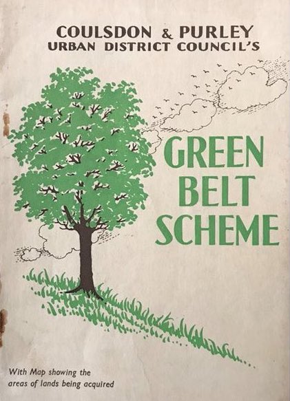
A pamphlet about the acquisition of Green Belt in Croydon, using LCC loans, 1937. Source.
‘Green Belt’ has, since 1955, been a planning designation, putting the brakes on urban sprawl on the outskirts of our largest cities. But prior to the creation of the national planning system in 1947, some London local authorities were already taking a lead in trying to protect land on the urban fringes from development – by literally buying up land not to develop.
As these two academic papers recount, the former London County Council (the precursor of the GLC and current GLA) set up a loans scheme in 1935 to help local authorities buy land for Green Belt. Within three years, something like 28,000 acres had been bought up by councils for preservation – often without a clear sense of what this land would be used for, only that it wasn’t to be built on. Objectives like recreation and public access only came later. This map from 1962 shows the areas (in black) purchased by municipal authorities for Green Belt; some appears to have been owned by boroughs, other bits by the LCC itself:

In 1965, the LCC was wound up and its lands passed to its successor body, the Greater London Council – which, under Ken Livingstone’s leftwing leadership in the 1980s, became a thorn in the side of Margaret Thatcher’s government, and so was abolished in 1985. Yet despite Thatcher’s keenness for privatisation, the c.12,500 acres of Green Belt land still owned by the GLC wasn’t flogged off, but rather was passed to county and borough councils, as this Ministerial letter makes clear.
Today a surprising amount of London’s Metropolitan Green Belt remains in the hands of local authorities. This GLA map, intended to identify potential areas for planting trees, shows council-owned Green Belt land in red:

One particular concentration is in Enfield, where Enfield Chase – a former Royal Forest that had been both a hunting ground and an actual wood – was sold by the Duchy of Lancaster in 1937 to form municipal Green Belt land. Today Enfield borough council and Hertfordshire county council own this former Duchy estate; the Duchy placed restrictive covenants over the land to limit its use to agriculture and recreation, and both councils have recently initiated plans to restore some of the area’s lost woodlands to help fight the climate emergency. The questions of whether more councils could be greening the Green Belt, and opening up public access to it so that people can reconnect to nature, are pressing ones.
Moorlands
Some northern councils have taken public access to the countryside very seriously indeed – by acquiring entire moors for their residents to go walking in. Sheffield City Council first bought a slice of Peak District moorland in 1927 when the Duke of Rutland sold off his Longshaw Estate grouse moor (the Duke still shoots grouse at Moscar moor to the north). At the time, the council wanted the land for water supplies, installing a reservoir under Carl Wark, before giving the moorland itself to the National Trust.
But Sheffield was then (as now) a hotbed of land rights activism, whose local Ramblers and CPRE branches were campaigning for greater public access to the moors and better protection of the environment. Local CPRE activist Ethel Haythornthwaite helped persuade wealthy benefactor Alderman Graves to buy Blacka Moor and gift it to the council for the people of Sheffield. She then campaigned for Sheffield to become the first English city outside of London to designate a Green Belt, including a ‘moorland reservation’. Today Sheffield City Council still owns moorland that closely follows the boundaries of this original proposal, and recently handed over management of the moors to the RSPB and National Trust:


An even more famous municipally-owned moorland is Ilkley Moor, owned by Bradford Council. Renowned for being the origin of the Yorkshire folk song ‘On Ilkla Moor baht ‘at’, it attained a different sort of notoreity in recent years as the only municipally-owned grouse shoot in the country when it was licensed for shooting by the council. A vociferous local campaign, however, led Bradford Council to end the grouse shooting lease in 2018.

Coastlines, salt marshes and foreshore
Two councils that I didn’t expect to be at the top end of the landowning league owe their positions to owning large stretches of beach and foreshore. Sefton Council (8th largest landowning council) owns a great 14,000-acre expanse of the sands that stretch out into the Irish Sea from the Ribble Estuary, including salt marshes and sand dunes along the shore, and appear to have acquired these in the mid-20th century (this blog by the local civic society suggests it was still owned by an aristocratic estate in the 1930s). Wirral Council owns an even bigger chunk of sand banks and foreshore in the Dee Estuary, some 15,227 acres. The council’s bizarre decision in 2019 to spray weedkiller over its beaches to control the harmless beach grasses earned it justified criticism.


Quite why Sefton and Wirral councils own so much foreshore is a bit of a mystery. The Crown Estate owns half the foreshore around England and Wales, with the Duchies of Cornwall and Lancaster owning a lot of the rest; I’m not aware of other local authorities being significant owners of the foreshore, but there could be more. Sefton and Wirral councils’ possession of so much foreshore helps explain why they get so little in farm subsidies, despite having such a large acreage registered with the Land Registry. (It should be noted that foreshore isn’t normally counted in the ‘landward’ acreage of England, but there’s no way of disaggregating this from the FOI’d Land Registry figures.)
Cornwall Council, meanwhile, owns no fewer than 26 beaches, mapped here.
Downland

Eric Ravilious, ‘Beachy Head’, 1939.
As we saw earlier, Brighton & Hove Council owns a large section of the South Downs (c.12,500 acres), as does Eastbourne Council further to the west (c.4,200 acres). Eastbourne acquired Beachy Head in 1929 following fears about encroaching development of the beauty spot; an Act of Parliament was passed to enable the council to use compulsory purchase powers to buy the land from the existing owners, who included the Duke of Devonshire.
Both authorities tried to sell off chunks of their downland estate in the 2010s (austerity striking once again), but the sales were halted following campaigns by local Friends of the Earth groups and other activists.
Highways

One thing we can readily conclude from looking at maps of council landownership is that many councils own large numbers of roads and verges. As Highways Authorities, county and unitary councils are responsible for road maintenance in their areas, but often they are also the freehold owners of said roads. To an environmentalist like me, this raises questions about whether the councils are using such land to best effect: why is so much urban space given over to the car, rather than cyclists and pedestrians? And why do councils persist in mowing roadside verges to within an inch of their life, rather than letting bee-friendly wildflowers grow on them?
Council housing and other municipal land in cities
I’ve focused above on the larger (and perhaps more surprising) expanses of rural and recreational land that councils own. Clearly, however, the core of most local authorities’ landholdings lies in urban centres – from town halls and council offices through to schools, libraries and council housing (or at least those estates not sold off under Right to Buy). By area, such landholdings are comparatively smaller but far more financially valuable than councils’ rural acres; they are also a lot harder to comprehensively map, comprising thousands of tiny parcels of land.
But two questions we can at least start to answer are: how far do some councils dominate land ownership within the cities they control? And how much has this changed over time?
We can get a handle on these by looking at a single case study, Manchester City Council. An academic paper from the 1980s on public ownership of urban land found that in 1982 Manchester City Council owned 16,710 acres within the city boundary, 57% of the city. Factoring in land owned beyond the city limits, the council then owned 20,900 acres – nearly twice as much as it does today. In other words, the council once owned the majority of Manchester; nowadays, the figures would suggest it has far less direct control over the city it runs.
The rise, fall – and rise? – of municipal landownership
Manchester’s experience is a microcosm of the wider story of council landownership. The modern system of local government was brought into being in 1888, when the Local Government Act created county councils and the LCC. The 1890s to the 1930s saw a great expansion in both the public functions of councils and the land they owned: the first wave of council housing, the growth of County Farms, the provision of allotments. The rise of Labour and Progressive parties through council elections sparked experiments in ‘municipal socialism’, with local authorities trialling interventions that Westminster dared not try.
We can see from the above examples that councils expanded their landholdings considerably during the interwar period, in response to concerns about conserving land from development and providing public access to the outdoors: Sheffield buying its first area of moorland in 1927, Eastbourne its downland in 1929, London boroughs purchasing Green Belt land in 1935-38. After World War Two there came another expansion in council land ownership: New Town Development Corporations on the one hand, new nature reserves and Country Parks on the other.
But after the late 1970s, councils – in common with the public sector as a whole – experienced a profound decline. We know County Farms halved in size from 1979 to 2018. And as the academic Brett Christophers has shown, the public sector as a whole saw the sell-off of millions of acres of land as part of Thatcher’s privatisation programme and Right to Buy. More recently, austerity has prompted a fresh wave of public land sales, as investigations by the New Economics Foundation and The Bureau for Investigative Journalism have shown.
Perhaps now, at long last, a corner has been turned. The economic recovery post-coronavirus will need strong local authority intervention to reshape our cities so that we can move about safely in a time of social distancing: roads repurposed for bike lanes and wider pavements, more green spaces opened up for the public to exercise in and get access to nature. The climate and nature emergencies, meanwhile, have not gone away, and councils will need to make good on all of their promises to respond to them, including in the way they use their land – to plant trees, restore moorland peat, and restructure cities to decarbonise transport. The new municipalism cannot come soon enough.
Summary of land types owned by councils – a very rough list, with likely overlaps and errors; please treat as a work-in-progress:
| Type | Area of England (unless otherwise stated) | Notes |
| County Farms | 208,000 acres | Declined from 400,000 acres in late 1970s |
| Allotments | 31,700 acres | Declined from 100,000 acres in 1948 |
| Local Nature Reserves | 105,000 acres | Majority owned by councils but not all. May be overlaps with moorland, foreshore and downland listed below |
| Country Parks | 108,000 acres | Majority owned by councils but not all |
| Municipal golf courses | ? | 311,000 acres across Britain; in London, 11,000 acres, 42% of which owned by councils. Unclear what proportion is elsewhere |
| Parks | 309,000 acres (across Britain) | Majority owned by councils but not all. Not been able to clip GIS dataset to isolate just English parks yet. |
| Metropolitan Green Belt owned by councils | c.28,000 acres | Assuming none sold off since 1930s, but some likely will have been. Overlaps with golf courses and Country Parks |
| Foreshore | 29,267 acres | Councils: Wirral (15,227 acres) and Sefton (14,040 acres) |
| Moorland | 7,883 acres | Councils: Sheffield (6,213 acres) and Bradford (1,670 acres) |
| Downland | c.16,700 acres | Councils: Brighton & Hove (12,500 acre) and Eastbourne (4,200 acres) |
| Total | ? 843,550 acres | |
| Other land not listed here | ? 480,682 acres | Inferred. E.g. council housing, offices, schools, highways, town halls |
| Grand total | 1,324,232 acres | From Land Registry FOI’d data 2015. |

Excellent exposé of municipal landholdings. A lot of work and very well done. Much to consider. How can this information gain a wider audience?
LikeLike
Having been gathering informally details of land ownership in Britain before Whoownsengland? came along with its systematic (and much superior) online information, I had guessed that the ownership of land by local authorities would probably prove collectively the largest land ownership in England. I was not far wrong. If you include the Government holdings, which includes MOD and Forestry Commission land, the state is by far and away the largest landowner in Britain. There were quite a few maps of local authority lands available several years ago but with differing formats and lack of consistency, but I noted at the time that Brighton seemed to own systematically all green spaces outside the town perimeter, complete ownership thwarted only by land owned by the National Trust and a golf course.
LikeLike
Further to my comment above, the issue of road ownership is a major one. If one takes a narrowish road to be 5 yards across, then a one mile length of road covers about 1.8 acres, thus a total road length of 247,000 miles in England gives an area of land of 447,000 acres. As we all know, many roads are massively wider that 15 feet, including verges. When doing my own research I understood (and I may be wrong and cannot quote the source) maintenance went with ownership and the A roads were Government responsibility and B and local roads those of local authorities.
Studying Capital taxation office maps of estates and the National Trust landmap, roads and country lanes are quite clearly excluded from ownership of any of these estates so are likely to be local authority. During the enclosures, a road was deemed to be fifty feet wide, although an awful lot of that got nicked by the farmers, but it is a pointer to how much of a probable underestimate I have made on road width.
This is a very large chunk of “orphan” land. I suspect that you could probably add another 350000 acres of roads at an absolute minimum to Council ownership.
LikeLike
The ownership of many roads rests ultimately with the frontager, not the local authority. A highway is a public right of way over land owned by others. Councils have powers and duties to maintain the highway, but not usually ownership of it. So long as it remains a road, frontagers have so little control over it they most are unaware of this, but if a road is ever closed the freehold normally reverts to adjoining property owners.
LikeLike
Thanks both Derek and William. Perhaps the answer is somewhere in between? The above map of what Durham Council owns (online here: https://maps.durham.gov.uk/OLBasic/Index.aspx?appid=59) seems to show the council owns quite a few major roads, as well as verges for other roads, in the county. But there are many other roads they don’t claim to own, perhaps where the frontager has ownership. As William says huge numbers of roads are unregistered land so it’s rather hard to find out definitively.
LikeLike
I have been trying for several years to obtain from Lincolnshire County Council the plans and subsequent copy title deeds to land in my village, in particular the gifting and compulsory purchase of land as verge, foot carriageway and road widening. To date they have not done so. There is a discrepancy by the council which has lead to incorrect mapping as old title deeds before 1929 have been used. The council refuse to say when they took over ownership of the questioned roads and from whom. Even with FOI request they sidestep saying they only own the first two spits of soil. Can you point me in a direction to obtain the correct information. Glad to have found your very interesting site.
LikeLike
No question of Lincolnshire CC side stepping the question, the situation relating to land ownership of roads is clear. For long established highways, as Derek has stated, land ownership rests with the frontager and the county council is responsible for only a theoretical two spits depth and also for asserting the highway rights of the public to pass and repass safely.
In the event that the highway was no longer required, then there would be a legal process known as stopping up under which the proposal would be advertised, objections received and resolved and the highway rights would be extinguished and the road closed. In that circumstance, the land would revert to the land owner each side, up to the mid point. The exception to the ownership above would be modern highways (mostly built since the thirties) where the highway authority has purchased land on which to build the road. By-passes and motorways would be good examples of this, but there are plenty of lesser roads. The highway authority is the county council or unitary council for most roads. However certain important A roads are designated trunk roads and Highways England is the highway authority for these and also for all motorways.
LikeLike
In 2019 Monmouthshire County Council bought Newport Retail Park. The retail park is within the Newport County Council authority. Is that land classed as council land for parking rules etc or as private land? Its confusing.
LikeLike
“I’m not aware of other local authorities being significant owners of the foreshore, but there could be more.”
Cumulatively, I think they would be significant. North Somerset Council owns the beach at Weston-super-Mare and this is not an uncommon thing in seaside resorts. Ownership gives the council control over, and the revenue from, the beach concessions: deckchairs, ice cream stalls, donkey rides, etc. Buying out the lord of the manor’s rights was an important expression of civic pride and not a move likely to be resisted by estates with better things to focus upon.
LikeLike