River basin planning: local measures case studies
Updated 21 October 2022
Applies to England

© Crown copyright 2022
This publication is licensed under the terms of the Open Government Licence v3.0 except where otherwise stated. To view this licence, visit nationalarchives.gov.uk/doc/open-government-licence/version/3 or write to the Information Policy Team, The National Archives, Kew, London TW9 4DU, or email: psi@nationalarchives.gov.uk.
Where we have identified any third party copyright information you will need to obtain permission from the copyright holders concerned.
This publication is available at https://www.gov.uk/government/publications/river-basin-planning-programmes-of-measures-case-studies/river-basin-planning-programmes-of-measures-case-studies
Case studies completed or being progressed from 2015
The case studies are set out by river basin district.
North West river basin district
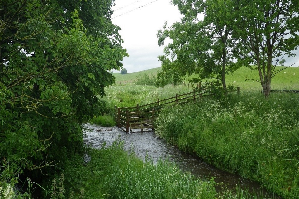
Cumbria and Lancashire river restoration strategy
Addresses physical modification, barriers to fish and wildlife and flood risk.
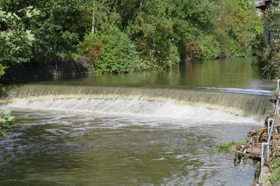
The image shows Bowston Weir on the River Kent surrounded by trees and vegetation and how the weir causes a large difference in river height.
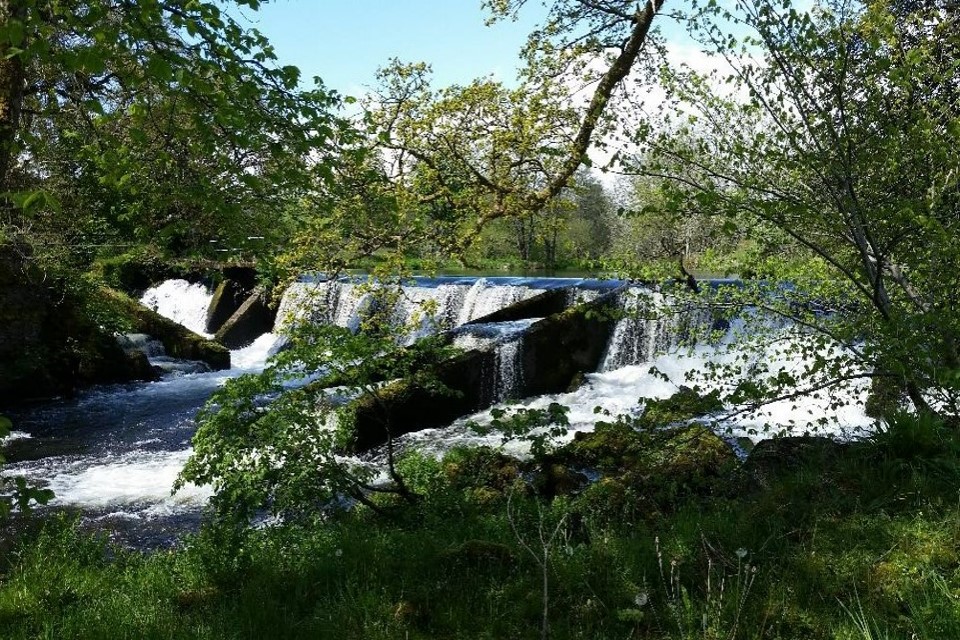
Bowston Weir, River Kent – impassable to fish. Credit South Cumbria Rivers Trust
This multi award-winning Cumbria river restoration programme is a three-way partnership involving: West Cumbria Rivers Trust, Eden Rivers Trust, South Cumbria Rivers Trust, local communities, Natural England, Environment Agency and other groups. They are enhancing and restoring rivers and floodplains in designated areas – improving our environment and reducing flood risk for people and wildlife. This partnership is achieving innovative river restoration. This is taking place at three Sites of Special Scientific Interest and Special Areas of Conservation catchments in Cumbria.
Since 2009, over 100 projects are completed from small to large scale construction. There is still much to do. Support is continuing with projects across all three catchments including Bowston weir removal - the largest weir ever removed in the UK. Also, this includes Grisedale restoration in Glenridding, a community devastated by Storm Desmond in December 2015. The Environment Agency is working with the North West Regional Flood and Coastal Committee and catchment partnerships exploring opportunities for natural flood management and more projects resulting in multiple benefits.
Natural Course – improving the whole North West water environment
The image shows a sustainable drainage scheme in the foreground – a drainage ditch filled with rocks of various sizes and vegetation. The background shows trees, a path, and houses.
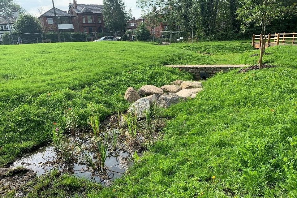
Natural Course project at Dales Brow, Salford – sustainable drainage scheme reducing urban diffuse pollution and surface water flooding from a nearby road. Credit Manchester City of Trees.
Natural Course is a partnership of public, private and third sector organisations, led by the Environment Agency. It was originally funded by the European Union LIFE Integrated Project. It is now integral to improving our understanding of how to overcome barriers to improving water environment in North West England.
Since 2015, £3 million has been invested in the Greater Manchester, Mersey and Cheshire area to trial new, innovative ways of working. So far, this partnership has addressed over 90 key challenges to the water environment. More than 11,000 individuals from 177 stakeholder groups have been engaged. As a result, the area is in a stronger position to positively influence policy and decision making.
Natural Course is mobilising more funding, including £14 million committed for:
- integrated working, using a natural capital approach for generating investment in the environment
- engaging stakeholders to bring the River Irk to life
- urban catchment forestry – managing urban water pressures
- constructing sustainable drainage systems like at Dales Brow
- the urban catchment operations approach to restoring rivers and solving physical modifications with the programme continuing improvements to the water environment
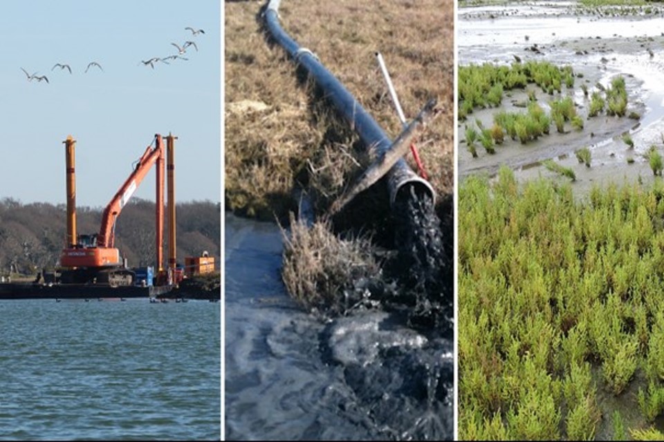
Force Crag mine – cleaning up metal pollution
The Force Crag mine operated from 1835 until 1991 and was the last working mine in the Lake District National Park. Cadmium, zinc and lead are washed out of the mine through drainage tunnels and from mining waste tips. These metals pollute 10km of rivers and Bassenthwaite Lake, harming fish and river insects. The mine is in a spectacular location at the head of the remote Coledale Valley, which is popular with hikers. The buildings and mine site are protected because of their nationally important industrial heritage and geology.
A partnership was created to devise a treatment scheme for capturing metals before they pollute the river. The Environment Agency, Coal Authority, Defra, and Newcastle University worked with the landowner, the National Trust, to develop a scheme respecting this sensitive location.
The resulting ‘compost-based pond’ system was built in 2014. It harnesses natural chemical and biological processes, capturing metals as the mine water passes down through a layer of compost and woodchips. The ponds were built in former waste lagoons, continuing the industrial story of this mining site.
The image shows a river running through Coledale Valley, with two ponds visible in the middle.
Force Crag treatment ponds and mine site. Credit John Malley.
The treatment system removes over 90% of the metals from the mine water, capturing nearly half a tonne of metals each year and improving water quality in 10km of local rivers. It is the first full-scale compost-based system at an abandoned metal mine in Europe.
Find out more about the Water and Abandoned Metal Mines programme.
Water and Abandoned Mines programme
Northumbria river basin district
Hartburn from Source to Delf Burn – tackling diffuse rural pollution
The image shows a herd of cattle in a field on the left next to a river to the right.
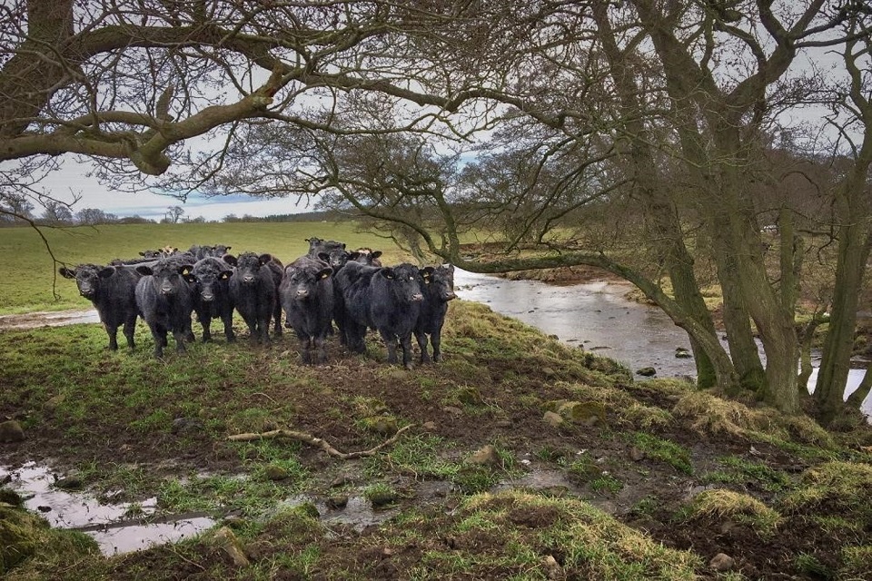
Livestock creating diffuse pollution issues in Northumbria. Credit National Trust
Work in the Hartburn catchment, Northumbria, is focussing on improving habitats and water quality in this rural catchment. Water quality was identified as being poor due to poor agricultural and rural land practices. This includes sedimentation due to livestock with direct access to the waters trampling of the banks also known as poaching.
The National Trust is leading a partnership aiming to reduce sediments and other pollutants entering the river. They are working with tenant farmers to improve land management practices and construct infrastructure. Completed work includes:
- 3.5 kilometres (km) fencing along water courses
- 17 field gates
- 4 solar water pumps with troughs supplying livestock drinking water
- creating 19.6 hectares of buffer strip
- 80 metres of in-channel improvements
This improves soil health, reduces soil erosion and pollution in the Hartburn, and improves biodiversity and land use practices within a profitable farming business model.
Severn river basin district
Unlocking the River Severn – reconnecting 158 miles of river habitat
In the 1800s, weirs were built along the River Severn in the industrial revolution for navigation and industrial uses, becoming barriers to migrating fish. The Canal and Rivers Trust are working in partnership with the Severn Rivers Trust, Environment Agency, Natural England and others to restore and reconnect 158 miles of river habitat. This will restore fish passage for twaite shad, allowing one of the rarest UK fish to reach its spawning grounds. Improving fish passage also helps other important species like salmon, eels and coarse fish.
There is an exciting and extensive education and community engagement programme. The programme is working with community groups along the river, including over 6,000 school children, and creating opportunities for volunteering and learning new skills.
The image shows a bridge over the river, behind which is a weir on the left, and a sloping fish bypass channel to the right.
Diglis weir bypass channel, Worcester. Photo Environment Agency, National Operations Catchment Services, River Basin Management Plan Team
Unlocking the Severn is funded by the Heritage Lottery Fund, EU LIFE Programme, The Waterloo Foundation and partners. Find out more in Unlocking the Severn – our river for people and wildlife.
Partnership achievements include:
- the Canal and River Trust installing fish passes at 4 weirs on the River Severn (these weirs are for are navigation so they could not be removed entirely):
- Bevere weir, north of Worcester – creating a 100 metre fish bypass channel, site landscaping and a riverside footpath completed autumn 2020
- Diglis weir fish pass near Worcester city centre – biggest fish pass of its kind (a deep vertical slot pass) in England and Wales and it includes an innovative underwater public viewing gallery (the viewing gallery is not yet open, but you can view film footage from the annual shad run)
- 2 more fish passes are being installed further upriver alongside Holt and Lincomb weirs and are due for completion in late 2021
- adapting 2 Environment Agency weirs on the River Teme to improve fish passage from 2019 to 2020 - one weir was partially removed, and one had a bespoke rock ramp added
Humber river basin district
Salmon reach Sheffield for the first time in over 150 years, River Don – addressing barriers to migrating fish and modified habitats
During the industrial revolution, large structures called weirs were built across many rivers in South Yorkshire. These weirs powered water mills, fuelling the early steel industry in Sheffield. Despite better regulation, changes in industry and greater investment improving water quality in the River Don, these barriers remained. This has been preventing salmon returning to upper catchments for spawning and generating future fish populations.
Over the last 20 years, many organisations worked in partnership successfully removing many barriers allowing salmon and other migratory fish species to return and complete their life cycle. There have been improvements to 18 weirs. This is making the Don passable for fish completing their spawning migrations from the North Sea to breeding grounds upstream of Sheffield. The Don Catchment Rivers Trust has an extensive ongoing volunteer programme involving 386 volunteers from Doncaster to Sheffield, 43 community organisations and 1,177 school pupils improving project sustainability.
After completing the final fish pass at Masborough, there is evidence of success with several salmon seen or caught, including salmon parr. This is the first time in 150 years salmon have successfully returned. Removing barriers and building fish passes cost around £6.4 million. The partnership is grateful to all funding sources including:
- public (51%): £3.27 million
- private (36%): £2.33 million
- Heritage Lottery Funding (13%): £802,000
Many people and organisations have been instrumental in achieving these improvements: Don Catchment Rivers Trust, private hydro scheme developers Barn Energy and UK Hydro Ltd, Templeborough Biomass Power Plant, Yorkshire Water, Sheffield City Council and the Environment Agency.
The image shows a sloping concrete fishpass on a river with buildings in the background.
Masborough fish pass, Masborough. Credit Yorkshire Water
SUNRISE – Stoke and urban Newcastle – restoring urban rivers
Launched in 2018, SUNRISE is an ambitious programme of 16 interlinked projects achieving a network of ‘green and blue’ infrastructure improvements across Stoke-on-Trent and urban Newcastle-under-Lyme. The aim is to improve water quality and river habitats in partnership with Stoke-on-Trent City Council, Newcastle-under-Lyme Borough Council, Staffordshire Wildlife Trust, Groundwork West Midlands, the Wild Trout Trust and the Environment Agency. One example is opening up a culvert to create 500 metres of new river meandering through the former Stoke City football ground. This replaces the existing concrete channel that contained a series of weirs, a barrier to migrating fish.
The SUNRISE partnership is securing funding for future improvements and ways to reconnect local communities with their environment.
The image shows a meandering river without concrete, surrounded by grass.
Moving the Trent, before and after – Victoria Ground. Credit Richard Guy, Staffs Wildlife Trust
The cost of this project was £3.6 million with multiple outputs including:
- communities better connected to their local green spaces
- reducing flood risk combined with other schemes
- more resilient river ecology to mitigate effects of urban diffuse pollution and climate change
- 130 hectares of improved habitats
- 25km of enhanced and improved river and brook corridors
- 0.5 hectares of remediated land
Northern Chalk Agricultural Impacts Project – improving groundwater
Diffuse agricultural pollution is a widespread issue for England’s groundwater. In largely arable counties like Lincolnshire, nitrate leaching from fertilisers and manures from agriculture continues impacting significantly on groundwater aquifers. This has a direct impact on the quality of water abstracted for our drinking water. A local partnership is taking a catchment based approach addressing elevated nitrate sources in groundwater. Within the water company Asset Management Plan 6 period of 2015 to 2020, Anglian Water worked closely with the Environment Agency on co-funded projects reducing nitrate leaching. This partnership will continue in Asset Management Plan 7 period until March 2025 with an approved business plan to continue partnership working with Anglian Water and other interests.
Since 2015, 9 partnership projects assessed how well different interventions are working, sharing outcomes and improving evidence.
This work has been successful, showing the measures are beneficial to farmers financially and from a soil health perspective. This partnership is sharing good practice widely which is being taken up by landholders across the target area. In the last 5 years this project has contributed 116km enhanced for groundwater in the Northern Chalk aquifer and counting.
The image shows a typical arable field in East Anglia. This one is being used as part of a cover crop field trial.
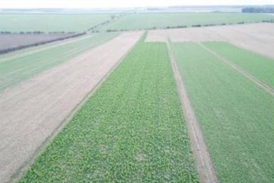
Cover crop field trial in North Lincolnshire. Credit ADAS.
Thames river basin district
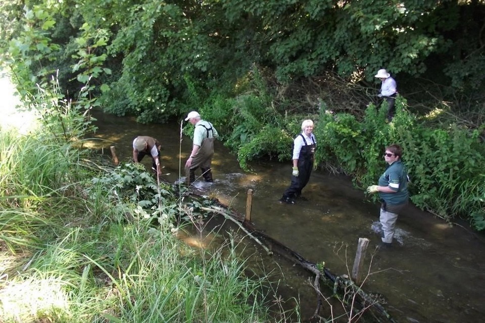
Rivers and Wetlands Community Days
River and Wetland Community Days (RWCDs) inspire community involvement and stewardship as volunteers engage in different safely planned tasks. These range from monitoring, to safely engaging in practical action improving rivers and wetlands for people and wildlife and reducing flooding through natural flood management.
In 2014, a group of organisations successfully established the innovative £1 million RWCDs programme: Thames Water, Angling Trust, Wild Trout Trust, Thames River Basin District Liaison Panel, Thames Regional Flood and Coastal Committee, River Restoration Centre, catchment partnerships and the Environment Agency.
Successes include:
- over 2,000 volunteers and 20,000 hours of time building capacity and capability, instilling greater knowledge for improving and caring for local waters
- increasing practical skills, fitness, mental health and wellbeing
- 85 partnership projects funded from source to sea in the Thames basin
- inspiring and achieving best practice: London Rivers Week, Outfall Safaris, Upper Thames natural flood management, Loddon Rivers Week and others
- celebrating World Rivers Day each year and other events, including London’s first Climate Action Week in 2019, Loddon Rivers Week
The image shows 17 volunteers on a river and wetlands community day, standing in a river in waders.
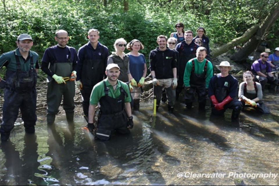
Volunteers in the Brent catchment, Bitterns Field. Led by Brent Catchment Partnership, Thames21. Credit John Sutton Clearwater Photography.
Fifty-two applications in the 2020 to 2021 round of funding shows the appetite for growing this successful partnership, in particular natural flood management and sustainable drainage. The funding total was just over £1 million:
- £292,000 Thames Water
- £690,000 plus match from catchment partnerships and community groups
- £50,000 Environment Agency in kind and Water Environment Improvement Fund
- multiple benefits are estimated to exceed £2 million
River Beane catchment partnership – restoring a chalk river
An aerial photo taken by Affinity Water showing the creation of a new river channel on the River Beane.
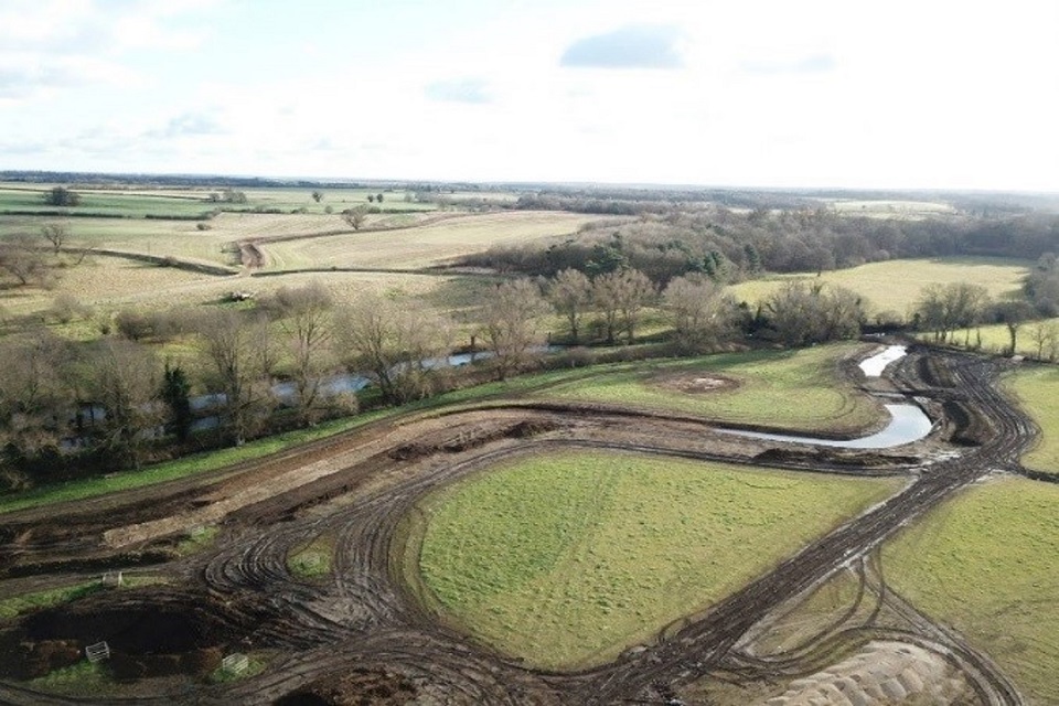
Restoring the River Beane. Credit Affinity Water
The River Beane partnership includes Affinity Water, local landowners, the Environment Agency among others.
This partnership is working together, restoring the River Beane, a globally rare chalk stream. Here river ecology has been severely impacted by low flows and artificial modifications to its watercourse. To help improve the environment, Affinity Water reduced their abstraction for public drinking water. The result of this is improving flows in the river. Several locations are now restored including Woodhall Park where 1.3 km of new river channel constructed is creating a more natural flow, habitats and bypassing barriers to fish.
Since 2016, 21km of river have been enhanced and 1.7km protected due to reduced abstraction and channel enhancements. This work has been done as part of Affinity Water’s National Environment Programme.
Thamesmead – enhancing canal habitats
The Thamesmead canal habitats project was initiated installing ‘floating islands’ in the Marsh Dykes catchment, a highly urbanised area of south London. The focus in this catchment was in Thamesmead, an area of housing and flats built in the 1960s. The river is in a concrete channel resembling a canal system. Since 2019, this partnership has been installing over 400 square metres of floating islands at 8 locations.
The image shows a floating island in the urban area of Thamesmead. The canal is divided into two strips by a thin, 1 metre by 10 metre island of grasses and small leafy vegetation. It demonstrates how you can improve the environment even in the most challenging of situations.
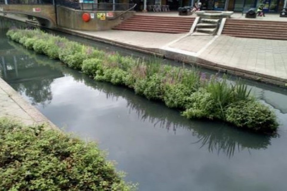
Floating islands at Thamesmead canal, Thamesmead – enhancing local spaces. Credit Thames21
The islands are designed to be multi-functional. They offer excellent habitats for nesting birds, invertebrates to live and fish to spawn and shelter from predators. They absorb excess nutrients helping mitigate pollution, oxygenating the water and making the canal’s ecosystem more climate resilient and a better place to live and work.
The local community took part installing islands and planting reeds, leading to people reconnecting with their blue spaces. Project partners include Thames21, London Wildlife Trust, Thamesmead Town Angling club, the landowner Peabody. Their approach formed a true partnership with everyone working together, producing a great outcome for the local area. The project was funded by Environment Agency Water Environment Improvement Grant over 2 years of £28,782 with match funding of £64,673.
Anglian river basin district
Finchingfield Brook – Natural Flood Management in Essex
The image shows a tractor and 3 people constructing a wooden structure in a field ditch to help retain water.
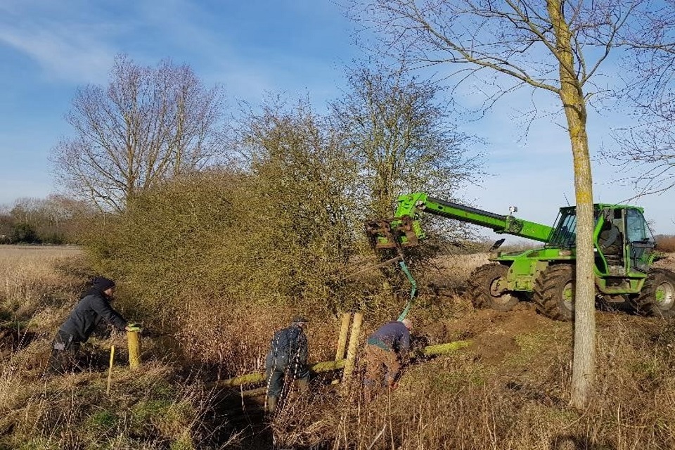
A leaky woody structure in construction, Finchingfield. Credit East Anglia Area Environment Programme Team
This natural flood management project is making a real splash. The project is aiming to slow the flow of flood waters into Finchingfield and gain maximum environmental benefits. Construction of traditional leaky woody structures is combined with creating a beaver enclosure on a smaller tributary. This partnership involves the Spains Hall Estate, King’s College London, Essex Wildlife Trust, Anglian Eastern Regional Flood and Coastal Committee and different partners.
The constructed leaky dams and beaver dams are working as intended, holding water on land after heavy rain and anecdotally reducing the severity of village flooding downstream. At the same time, the mosaic of wetlands created by beavers have become a haven for wildlife by exponentially increasing the landscape diversity. Leaky log jams are promoting cleaner gravels, and the partnership expect this to benefit invertebrates and spawning fish.
This project was part funded by the Anglian Eastern Regional Flood and Coastal Committee, with the Environment Agency contributing project support, monitoring, and evaluation helping to maximise the benefits.
South East river basin district
The Aquifer Partnership, South Downs – safeguarding drinking water
The Aquifer Partnership (TAP) is a partnership involving South Downs National Park Authority, Brighton and Hove City Council, Southern Water and the Environment Agency. This wide-reaching programme is working with schools, residents, farmers and landowners across the Brighton, Hove and Lewes area. It is safeguarding drinking water for 1.2 million people. Over 70% of Southern Water’s groundwater sources in the Brighton area have rising nitrate levels needing treatment or needing a catchment based solution to manage levels.
An aerial image of a typical view of the South Downs catchment – rectangular fields and occasional islands of woody areas across a hilly landscape.
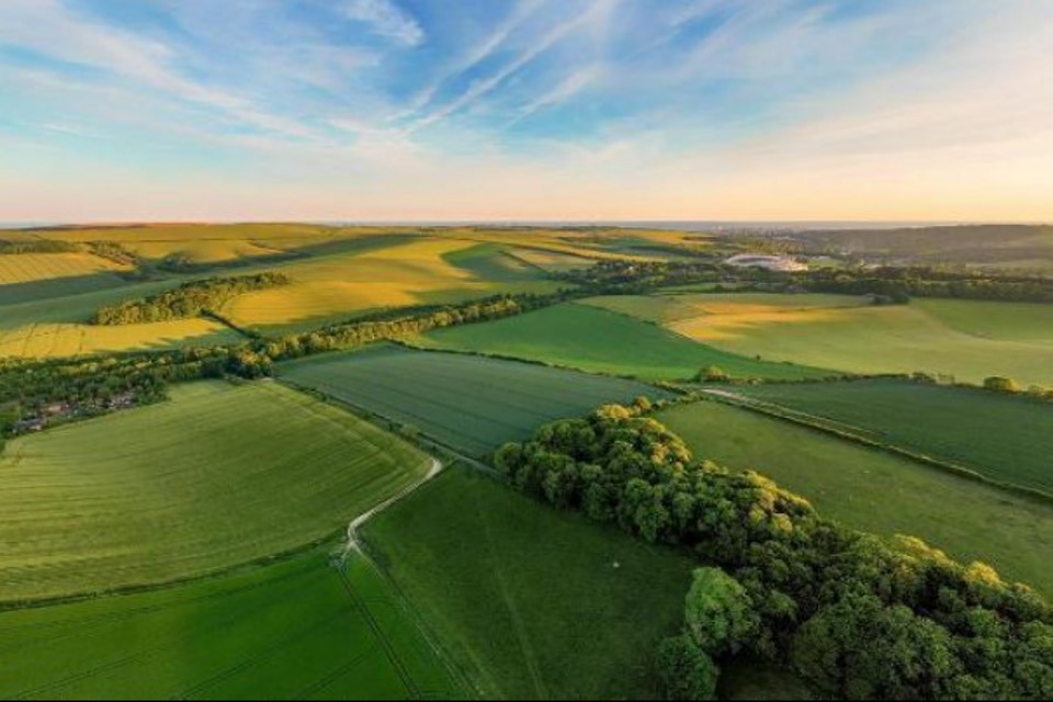
Catchment landscape ‘protecting our precious groundwater’. Credit The Aquifer Partnership
Strengthening the ecological profile of land by improving soil quality. One trial sees a farmer apply nitrogen fertiliser directly to the crop leaf, rather than the traditional granular fertiliser spread across soil. Research shows around half of all artificial nitrogen applied to crops in traditional techniques escapes to chalk rock beneath, or is lost to the atmosphere. But, by applying directly to the crop leaf, the hope is less nitrogen is lost to leaching, reducing this by 50% and significantly.
Another farm is trialling ‘regenerative grazing’, where livestock graze more intensively but for shorter periods. As a result, pasture is rested for longer periods which allows grasses to recover and herbs to improve soil quality. Healthy soils, full of plant roots, invertebrates and microscopic life are vital to reducing nitrate leaching and a major carbon capturer - a key way to reduce global warming by taking carbon dioxide out of the atmosphere.
Upper Great Stour – Buxford fish bypass channel – restoring rivers and addressing barriers to migrating fish
Buxford Mill weir presented a significant barrier to migrating fish. The preference is normally for removing barriers and returning rivers as close to natural conditions as possible. However, at Buxford Mill the buildings and structures are historically important, so a nature like bypass channel for fish and wildlife is a good alternative.
Working with many partners, the Kentish Stour Countryside Partnership led on installing a bypass channel, fitting in with local surroundings and using locally sourced Ragstone rock and timber. The bypass consists of six pools and riffles, allowing fish to swim up through gaps in each riffle and then resting in pools before entering the main river. From there fish can swim upstream to spawning grounds and back, and for some, to sea.
The image shows a small river in a forest with pools between each riffle.
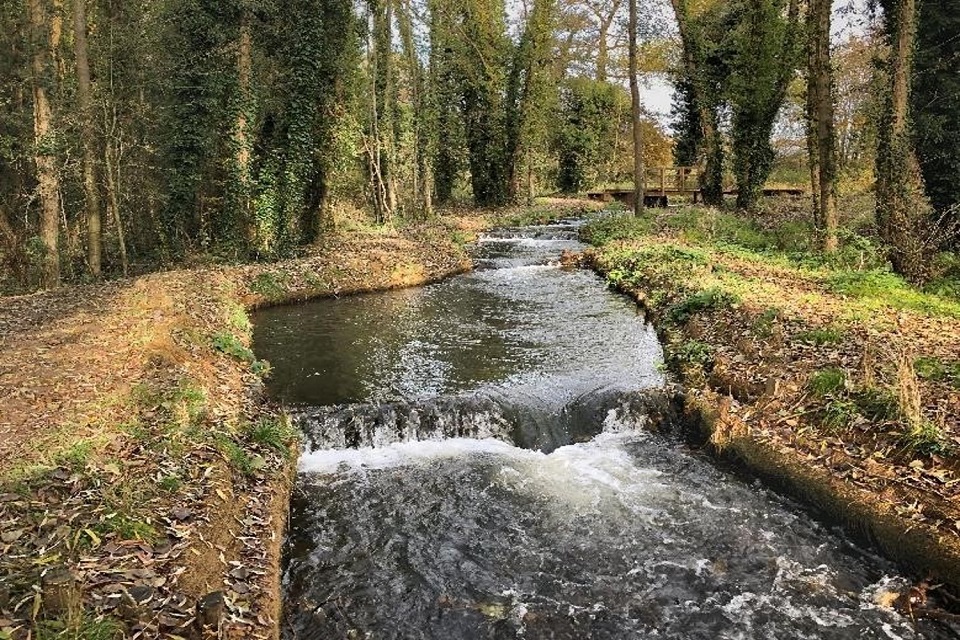
Buxford completed nature-like bypass channel. Credit Environment Agency Kent and South London Fisheries, Biodiversity and Geomorphology Team
The bypass is attracting visitors, so the partnership is working together on an information board giving a brief site history, the purpose of the project, and health and safety messages. This project is improving river water quality, because now it flows in a defined channel there is less silt entering the river. This is beneficial for fish breeding as silt can smother gravels. The total project cost was £127,000. It was jointly funded by the Environment Agency through the Water Environment Improvement Fund and Flood and Coastal Risk Management.
South West river basin district
Bristol Frome re-connected – integrated catchment management
The image shows a concrete slanted weir for a river, with proposed construction shown in red lines: three parallel lines along the weir, with gaps to allow fish passage at the side.
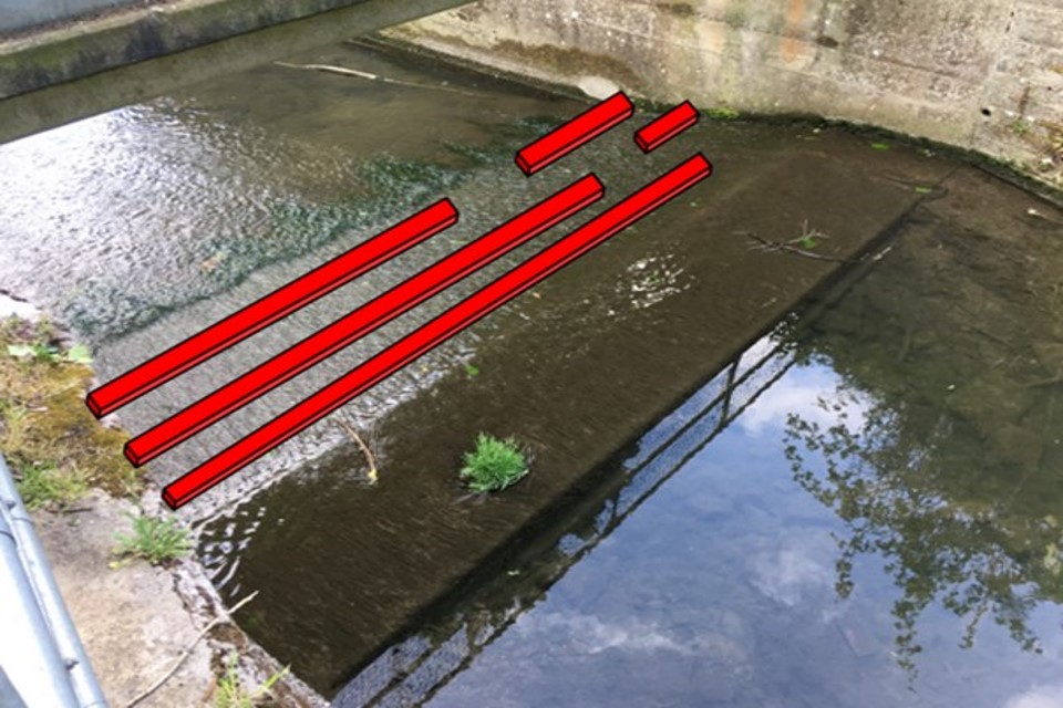
Fish passage proposals for an Environment Agency flood asset structure in Yate, construction starting autumn 2021. Credit Environment Agency Wessex Area Fisheries, Biodiversity and Geomorphology Team.
‘Bristol Frome re-connected‘ is an initiative working with different delivery partners steering improvements in the Frome catchment. The Bristol Frome catchment has 8 waterbodies and 9 major flood risk schemes affecting 1500 properties at risk of flooding. The Frome runs through Bristol city and is suffering from historic neglect and under continual pressure due to increasing urbanisation. This partnership is aiming to:
- helping communities with well-planned places – 2 major sites of future redevelopment
- reducing flooding risk and improving rural land management in Ladden catchment
- enhancing ‘green and blue’ corridors by planting new woodlands
- creating fewer barriers for fish and eels and enhancing habitats for nature recovery
River Axe Special Area of Conservation – using existing regulations to tackle agricultural and rural land pollution
The image shows an earth banked lagoon constructed after regulatory advice in the River Axe catchment
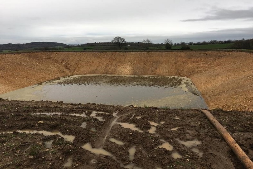
Earth banked lagoon constructed after regulatory advice in the Axe catchment. Credit Environment Agency Devon, Cornwall and Isles of Scilly Area Environment Programme Team
The River Axe Special Area of Conservation is being polluted by poor agricultural and rural land activities, causing nutrient enrichment and sediment. This is leading to loss of habitat and fish species.
The Environment Agency secured £120,000 of local funding for 3 years of targeted regulatory farm visits between 2016 and 2019, carrying out 86 farm audits. These advice-led, but regulatory, visits are supporting farmers and landowners in reducing pollution. They have led to constructing and making:
- 33 slurry stores
- 3 silage clamps
- 10 fuel stores
- 21 infrastructure repairs
Initial evaluation of these improvements is suggesting that 30km of the River Axe have been enhanced. For every pound of funding on this project, 33 pounds of investment were made in the catchment. This evaluation demonstrates the power of advice, backed up by regulation and supported by financial incentives.
This is creating positive benefits for both farm businesses and the environment. This approach can be adapted and adopted to other priority catchments in England, with potential for generating similar improvements for relatively small regulatory investment.
Examples of 2021 to 2027 river basin management plan case studies across England’s river basins
North West river basin district
Catchment partnerships – addressing barriers to migrating fish
Historically across North West England, water played a major role in the prosperity of this region by powering businesses and manufacturing in towns and cities. However, the legacy of its infrastructure left a negative impact on our natural environment. Thousands of weirs built in our rivers and streams are preventing free movement of fish and wildlife. This has a significant impact on fish populations, reflected in the fisheries classification of many rivers.
The image shows a river with a weir across it.
Collyhurst Weir River Irk, Credit Environment Agency.
Since 2015, catchment partnerships made considerable investment in removing weirs and constructing fish passes, but there is still much to do. From 2021 to 2027, these partnerships will continue addressing barriers to migrating fish through a rolling programme of action resulting in real on-the-ground achievements. Examples of potential future work with partners include the Victoria North development on the River Irk in Manchester. This is where there are several barriers to fish migration that need to be considered for removal or fish passage. The Environment Agency are also working with partners on the River Darwen looking at several weirs.
Northumbria river basin district
Tees Tidelands partnership – an integrated approach to restoring habitats, reducing flooding and using carbon credits
The Tees Tidelands partnership is led by Stockton Borough Council. This partnership is seeking an integrated approach to restoring habitats and managing flood risk in the Tees estuary. The partnership was awarded £6 million over 2021 to 2027 as part of the government’s new Flood and Coastal Resilience Innovation Programme. The partnership will achieve this project alongside multi-million-pound investment in the Tees estuary from the Environment Agency capital flood resilience programme.
An aerial image of flooding at Holme Fleet, Port Clarence, Tees Estuary, March 2021. Fields are fully submerged except for a few roads, and a city is visible in the background.
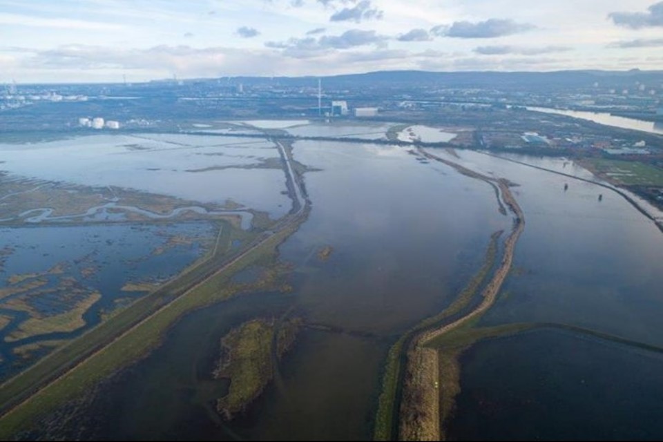
Flooding at Holme Fleet, Port Clarence, Tees Estuary, March 2021. Credit Environment Agency
Emerging biodiversity and carbon credit markets will be used, creating cyclical funding for reinvestment in regeneration. A local habitat and carbon banking mechanism will harness credits from creating habitats and a Port Clarence village demonstrator site will achieve:
- restoring and creating intertidal habitat on land currently impacted by antisocial behaviour
- improving community resilience by increasing awareness and take-up of flood warning services, and improving local flood defences
- a regionally significant Tees Tidelands Trail for improving engagement with communities on their estuary, promoting health and well-being benefits of connected blue space
- climate resilience – high carbon sequestration from intertidal habitats created through this partnership contributing to a zero-carbon future
- enhancing extensive physical modifications, creating a nature recovery network, and improving the water environment
The market for biodiversity and carbon credits will incentivise landowners to create habitat, driving sustainable economic growth in the Tees Valley. Income will provide circular and innovative funding for reinvesting in a strong and strategic Tees Estuary Partnership to achieve their habitat vision. This proposal is scalable: it could potentially be expanded to other habitats and the Tees Valley sub region. The legacy of the Tees Tidelands will be a vibrant environment for both wildlife and people, with nature valued to fund climate resilience and ecological improvements well into the future.
Severn river basin district
A multi partner, whole catchment approach, creating multiple benefits for the environment and community of the Rea Brook, Shropshire
The Rea Brook has an abundance of natural heritage including a National Nature Reserve, Area of Outstanding Natural Beauty (AONB), Site of Special Scientific Interest and Marton Pool, a Ramsar site. Diverse habitats support many protected species such as Curlew and Dormouse. In contrast to the surrounding terrestrial environment, the aquatic habitat and biodiversity is poor and, in some cases, deteriorating in quality.
The Rea Brook is an England-Wales cross border catchment. This has provided challenges in the past regarding securing funding for catchment enhancements. However, in 2019 partners were successful in securing funding through the Water Environment Grant Scheme for the REAction project. Three years on and partners have secured further funding, supporting an array of partnership projects improving the aquatic environment.
Over the last 3 years successes include reconnecting floodplains, removing barriers to fish, planting over 8,000 trees, improving farms within the catchment and enhancing habitat for water voles and curlews.
The image shows a bridge over a river, with a fish pass installed.
Kingfisher Bridge fish pass installed. Credit West Midlands Environment Programme Team.
Funding has been secured that will allow partners to continue achieving further enhancements for the environment and community. This multi partner, multi beneficial and whole catchment approach helped the Severn Valley Water Management Scheme to identify the Rea Brook as the preferred location for demonstrating the benefits of nature based solutions. Work will start in 2022 with a flood risk driver to create an exemplar catchment demonstrating that nature based solutions can reduce downstream flood risk.
Water Environment Improvement Fund Grant in Aid funding has been secured for partners to continue their ongoing work to deliver enhancements with more of a water quality and biodiversity driver. Funding through an enforcement undertaking will enable engagement with the Rea Valley community to enhance their understanding and appreciation of their water environment, upskilling the community and encouraging participation in citizen science.
Humber river basin district
Mackworth and Markeaton Brook partnership, Derbyshire – addressing diffuse rural pollution
This partnership is addressing water quality issues from rural diffuse pollution in the Lower Derwent catchment, Derbyshire. It continues until at least 2023, involving landowners and farmers, the National Trust, Severn Trent Water, University of Derby and the Environment Agency. This partnership is a hub of the larger Derbyshire Derwent Catchment Partnership.
The National Trust have been working successfully in this catchment for several years building strong relationships with landowners and identifying interventions for:
- reducing livestock access to waters
- reducing phosphate levels
- controlling signal crayfish within Markeaton Lake, a source of sediment and phosphate
The partnership has completed interventions at over 30 farms including:
- 12.3km of fencing
- 20 drinking bays
- 2 papa pump systems (low cost pump delivering water without need for electricity or fuel) and 1 pasture pump
The image shows a rocky path for cattle to access a drinking area, surrounded on both sides by fencing. In the background, fields and trees are visible.
Cattle access drinking area reducing diffuse pollution from poaching. Credit Environment Agency, East Midlands, Environment Programme Team
Upper Aire Land Management and Habitat Project, Yorkshire
The Upper Aire catchment covers an area of 356.85km2 from Malham to Keighley, with a total watercourse length of 174km. A partnership project has been established between the Environment Agency, the Yorkshire Wildlife Trust, Yorkshire Farming and Wildlife Partnership and The Wild Trout Trust with the aims to:
- reducing diffuse agricultural pollution, particularly sediment, to improve water quality and habitat in the watercourses
- raising awareness with landowners of the sources of diffuse pollution
- managing invasive non-native plants, allowing native species to re-establish and providing better habitat
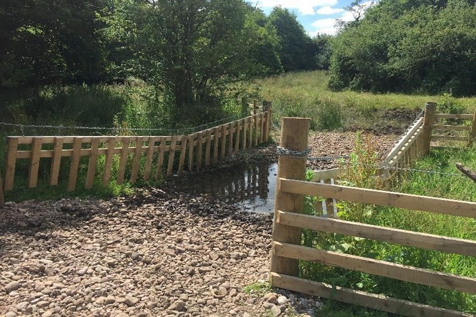
The image shows a small stream in a field. In the centre of the image there a fenced path leading into the river.
Otterburn buffer fencing and riparian drinking area ‘after’ note re-established riparian habitat (2019)
Although established in 2011, we have secured funding for 2021 to 2023 to continue the project further. Since 2011, we have worked throughout the area and have reduced the amount of sediment entering the watercourses using a combination of landowner education and capital projects, such as buffer strip fencing and riparian tree planting. Beneficial outcomes include reduced loss of soil and nutrients from farmland, improved water quality, slowing river flow, a cooling effect on water courses, and improved habitat and biodiversity in the riparian zone.
Using our existing relationships in the catchment our project partners are currently delivering schemes on behalf of the Leeds Flood Alleviation Scheme natural flood management project. They are helping to reduce the peak flow in Leeds with additional benefits to water quality, fish and wider biodiversity.
Project funding is from the Environment Agency’s Water Environment Investment Fund programme, along with other smaller funding streams such as the Fisheries Improvement Programme. To date direct funding adds up to just over £480,000.
Since 2011, the project has enhanced 119km of waterbodies, approximately £1 million match funding (a return of 2:1 for the £480,000 investment), plus improvements to the classification status of the waterbodies.
Thames river basin district
River Thame, Stadhampton Mill bypass channel – improving climate resilience of chalk rivers, improving fish passage and creating habitats
Working in partnership with the River Thame Conservation Trust, the Environment Agency is creating a nature like bypass around The Mill House weir in Stadhampton, a barrier to fish and wildlife.
A new meandering channel will be constructed through adjacent flood meadow, re-instating the original line of the Chalgrove Brook. Other habitat improvements are also being carried out. These will open up and enhance 3.25km of chalk stream habitat currently impassable to fish.
This project is part of a catchment strategy removing barriers to fish and restoring wild trout among other fish species to key tributaries of the Thame and Thames. In channel habitat improvements will also improve biodiversity for wildlife, including fish and invertebrates, while helping the catchment become more climate resilient.
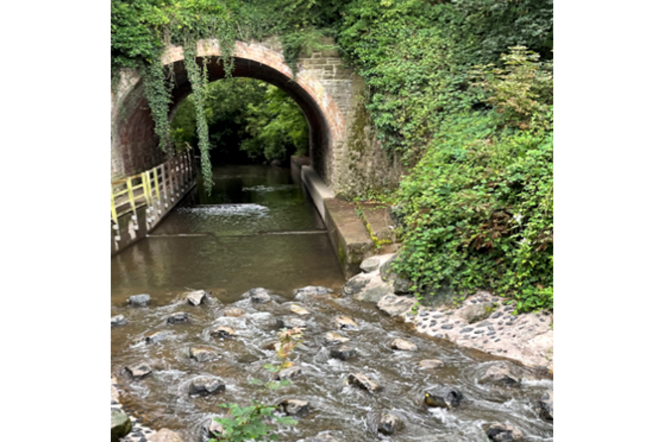
The image shows a river running through a nature life fish and wildlife bypass channel – a low wooden weir.
Stadhampton Mill weir, site of nature-like fish and wildlife bypass channel. Credit River Thame Conservation Trust
London – tackling pollution from urban road run-off
A partnership has formed developing a new model studying pollution from London’s roads. It includes the Greater London Authority, Transport for London, Thames21, Middlesex University and the Environment Agency. The model uses vehicle numbers and types, predicting amounts of pollution deposited on roads and damage to our rivers. This project was supported by the Zoological Society of London, Thames Water and South East Rivers Trust. More information is in the Road Runoff Water Quality Study Executive Summary.
An image from an interactive map showing road water runoff in London based on the project model. The main roads of outer London are shown with colours indicating run-off water quality: dark brown and red is worst quality, orange is medium, grey is least. White roads were not analysed.

London road run-off water quality map an important tool for engaging partnerships and finding innovative solutions. Credit Greater London Authority
This study identified roads with the greatest potential to contribute pollution to London’s rivers. It’s showing the best locations for interventions. Modelling is limited to outer London, because in outer London there is a separate surface water system. Surface water is rainwater collecting from roofs, driveways, drains and gutters. In outer London, surface water drains directly to rivers through a separate surface water sewage system. Whereas central London has a combined drainage system. This is where surface water drains alongside domestic foul water pipes to sewage treatment works. Modelling from this project applies only to major roads in outer London for which Transport for London have modelled or observed vehicle movement data. This is nearly 40,000 kilometres or 75% of London’s major roads.
These results are helping partners identify the most appropriate types of roadside sustainable drainage systems and new opportunities for creating wetlands in priority locations. Interventions aim to provide additional benefits: reducing flood risk, climate resilience, improving amenity, greater biodiversity and local air quality and cooling effects. These solutions can be embedded into future highways and flood risk work to scale up, generate cost savings, and achieve climate resilience and a better place to live and work.
River Crane Catchment Partnership – restoring a concrete channel
The Crane Valley Partnership is embarking on an ambitious project restoring 3km of the lower River Crane. This is between the split with the Duke of Northumberland’s River and Cole Park Island. This section is currently a bare concrete channel and often hidden from view.
The Crane Valley Partnership is aiming at:
- creating a more natural river full of plants, fish and wildlife, running through re-landscaped parks and open spaces
- improving public facilities and making an accessible riverside path
- creating more space in the river channel for water and wildlife, and reducing flooding risk
The image shows a river in a bare concrete channel with grass on the left side and a tree on the right side.
Restoring this concrete channel to an accessible and enhanced corridor is a key aim for the Crane Catchment Partnership. Credit John Waxman, Crane Valley Partnership
Anglian river basin district
River Stour catchment enhancement project, improving river and floodplain habitats
Partners in the Stour catchment are working with the Dedham Vale AONB team and the Stour Farmer Cluster. Over the next 6 years they are achieving practical river habitat enhancements, such as:
- riparian tree planting, installing large wood, creating backwaters and scrapes
- controlling priority invasive non-native species
- improving water quality in the River Stour
This project achieves multiple benefits including an excellent working relationship between the Environment Agency and Dedham Vale AONB team who are Suffolk County Council officers. The AONB report to a wide range of District and County Council Members. This partnership approach continues being a great way of working with elected Councillors and the Stour Farmer Cluster.
This project involves local parishes and communities in volunteering, planting trees and controlling invasive non-native species. It is creating strong relationships with the influential Stour Farmer Cluster group whose members are significant landowners. This is enabling partners to understand each other’s aspirations, what is possible and what may be harder to achieve. The Environment Agency contribute approximately £40,000 Water Environment Investment Fund investment each year, to an overall annual project cost of about £80,000.
The image shows 5 volunteers standing in a river, wearing waders and installing woody fish mattress habitats.
Installing woody ‘fish mattress’ habitats with Dedham Vale AONB volunteers. Credit Matthew Holden, former River Stour Officer, Dedham Vale AONB Team
Appointing an integrated officer, Lincolnshire and Northamptonshire
Anglian Northern Regional Flood and Coastal Committee are allocating £300,000 of local levy funding in the next 6 years. This is for an Environment and Natural Flood Management Officer in the Welland and Nene catchments. It follows a successful trial of this role, funded locally by the Environment Agency since 2018. This role will focus on enabling nature based solutions to flood risk while completing environmental objectives and tackling diffuse pollution challenges.
In the last 12 months, new relationships and a dedicated understanding of stewardship has seen this post attract over £350,000 of funding to one site and creating five similar opportunities. These direct engagement opportunities are advantageous for raising awareness of natural flood management measures, reducing downstream flood risk, and improving biodiversity and water quality. This proactive engagement is mostly with large country estates, where the size of land holding makes it an efficient route to influence as much change, scale, and benefits as possible.
South East river basin district
Beneficial Use of Dredging in the Solent
Beneficial Use of Dredging in the Solent (BUDS) is a Solent wide coastal habitat restoration initiative, with a pilot in the Western Solent. It is a collaborative project involving the Solent Forum Coastal Partnership, Natural England, Environment Agency, Lymington Technical Services, River Hamble Harbour Authority, New Forest Distinct Council and Associated British Ports.
Each year, maintenance dredging in the Solent results in excavation of over 1 million cubic metres of sediment, which is disposed at sea. Only 0.02 per cent of this sediment is used for protecting and restoring saltmarshes and mudflats, despite progressive deterioration and erosion of our protected estuarine and coastal habitats. These lost habitats provide important ecological and socio-economic functions, reducing coastal flood protection, providing carbon storage and acting as refugia for biodiversity.
BUDS aims at:
- achieving beneficial use of dredging in the Solent in a phased approach
- scoping and costing sediment sourcing and identifying sediment receiver sites
- building protocols and guides for restoring marshes, using various techniques
Phase 3, 2021 to 2022: securing licences and permissions and agreeing an operating system, enabling a sustainable funding model for future schemes (funding – £60,000).
Phase 4, 2022 to 2027: carrying out a major recharge project in the Western Solent marshes. Using this template to main-stream BUDS across the Solent and wider marine environment and sharing lessons learned.
Shows a collage of 3 images of beneficial dredging in the Solent. The first image displays a mechanical dredger in action. The second the dredged material being pumped onto mudflats. The third shows regeneration on the mudflats.
Beneficial dredging in the Solent. Credit ABPmer
South West river basin district
Co-ordinated Response for Intertidal Taw Torridge Estuary Restoration (CRITTER)
The CRITTER project is taking place in the North Devon management catchment focussing on the Taw Torridge estuary and watercourses feeding it. Two main aims are:
-
Mitigating estuary modifications: Artificial modification for flood defences resulted in this estuary having an artificial tidal prism and losing saltmarsh. This project seeks locations for breaching existing flood banks creating new intertidal habitat and helping naturalise the tidal water. This will help restore valuable saltmarsh and sequestering carbon, contributing to climate resilience. Additional benefits from integrating with the Barnstaple flood scheme are reducing property and infrastructure flood risk, improving the resilience of the Taw Torridge estuary to a changing climate.
-
Enhancing freshwaters feeding the Taw Torridge estuary: continued partnership approach achieving water quality enhancements through advising, guiding, and regulating activity.
This partnership will be monitoring and evaluating its work. This is to help improve our shared understanding of the relative importance and impact of advice and guidance for water quality, alongside capital projects.
This project involves multiple partners, led by North Devon Biosphere. The partnership expects to be active over 5 years, with a total budget around £1.5 million.
Preventing plastics pollution
We are finding plastic in our land, rivers, ocean, and the air we breathe. Its presence in our environment not only affects living organisms, but our wellbeing too. Plastic pollution is a great way of engaging people in conversations about less visible environmental challenges, like the climate and biodiversity emergency.
Image showing a small sandcastle built out of microplastic debris
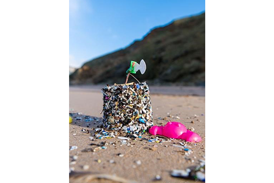
Microplastics Sandcastle – approximately 5,000 pieces of plastic are found every mile of beach in the UK. Credit Marine Conservation Society, 2016.
The Environment Agency is working in partnership with 18 organisations across England and France. They are understanding and reducing the impacts of plastic pollution in our soils, rivers and seas. The €14 million ‘Preventing Plastic Pollution’ project received funding from the Interreg France Channel England Programme.
In England, this project is working from Cornwall to East Anglia, focussing on the Tamar, Poole Harbour, Test and Itchen, East Hampshire, Medway and Great Ouse catchments. This is along with 3 catchments in northern France. This project aims at reducing plastic pollution from source to sea.
Using a catchment based approach, this project is:
- identifying and targeting plastic hotspots from source to sea
- embedding behaviour change in businesses and communities
- developing education programmes and implementing innovative solutions
- sharing information from research and citizen science to help cross-channel partnerships tackling some of the 4 million tonnes of plastic waste entering our sea from rivers worldwide every year